Montabot
Montabot ist eine französische Gemeinde mit 276 Einwohnern (Stand 1. Januar 2019) im Département Manche in der Region Normandie. Sie gehört zum Arrondissement Saint-Lô und zum Kanton Villedieu-les-Poêles-Rouffigny.
| Montabot | ||
|---|---|---|
| ||
| Staat | Frankreich | |
| Region | Normandie | |
| Département (Nr.) | Manche (50) | |
| Arrondissement | Saint-Lô | |
| Kanton | Villedieu-les-Poêles-Rouffigny | |
| Gemeindeverband | Villedieu Intercom | |
| Koordinaten | 48° 56′ N, 1° 8′ W | |
| Höhe | 85–272 m | |
| Fläche | 11,66 km² | |
| Einwohner | 276 (1. Januar 2019) | |
| Bevölkerungsdichte | 24 Einw./km² | |
| Postleitzahl | 50410 | |
| INSEE-Code | 50334 | |
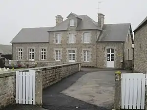 Mairie Montabot | ||

Sie grenzt im Norden an Beaucoudray, im Nordosten an Tessy-sur-Vire, im Südosten an Gouvets, im Süden an Margueray (Berührungspunkt) und im Südwesten und Westen an Percy-en-Normandie.
Bevölkerungsentwicklung
| Jahr | 1962 | 1968 | 1975 | 1982 | 1990 | 1999 | 2008 | 2018 |
|---|---|---|---|---|---|---|---|---|
| Einwohner | 450 | 395 | 352 | 329 | 290 | 272 | 291 | 277 |

Kirche Mariä Himmelfahrt
This article is issued from Wikipedia. The text is licensed under Creative Commons - Attribution - Sharealike. The authors of the article are listed here. Additional terms may apply for the media files, click on images to show image meta data.