Bourguenolles
Bourguenolles ist eine französische Gemeinde mit 345 Einwohnern (Stand 1. Januar 2019) im Département Manche in der Region Normandie. Sie gehört zum Kanton Villedieu-les-Poêles-Rouffigny und zum Arrondissement Saint-Lô.
| Bourguenolles | ||
|---|---|---|
| ||
| Staat | Frankreich | |
| Region | Normandie | |
| Département (Nr.) | Manche (50) | |
| Arrondissement | Saint-Lô | |
| Kanton | Villedieu-les-Poêles-Rouffigny | |
| Gemeindeverband | Villedieu Intercom | |
| Koordinaten | 48° 48′ N, 1° 18′ W | |
| Höhe | 91–184 m | |
| Fläche | 7,73 km² | |
| Einwohner | 345 (1. Januar 2019) | |
| Bevölkerungsdichte | 45 Einw./km² | |
| Postleitzahl | 50800 | |
| INSEE-Code | 50069 | |
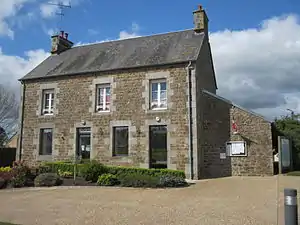 Mairie Bourguenolles | ||

Sie grenzt im Norden an La Lande-d’Airou, im Nordosten an Villedieu-les-Poêles-Rouffigny mit Rouffigny, im Osten an La Trinité, im Süden an Le Parc mit Sainte-Pience und im Westen an Le Tanu.
Bevölkerungsentwicklung
| Jahr | 1962 | 1968 | 1975 | 1982 | 1990 | 1999 | 2008 | 2018 |
|---|---|---|---|---|---|---|---|---|
| Einwohner | 322 | 256 | 225 | 206 | 250 | 244 | 300 | 344 |
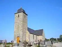
Kirche Saint-Barthélemy
This article is issued from Wikipedia. The text is licensed under Creative Commons - Attribution - Sharealike. The authors of the article are listed here. Additional terms may apply for the media files, click on images to show image meta data.