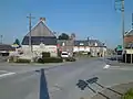
Dangy
Dangy ist eine französische Gemeinde mit 682 Einwohnern (Stand 1. Januar 2019) im Département Manche in der Region Normandie. Sie gehört zum Arrondissement Saint-Lô und zum Kanton Saint-Lô-2.
| Dangy | ||
|---|---|---|
| ||
| Staat | Frankreich | |
| Region | Normandie | |
| Département (Nr.) | Manche (50) | |
| Arrondissement | Saint-Lô | |
| Kanton | Saint-Lô-2 | |
| Gemeindeverband | Saint-Lô Agglo | |
| Koordinaten | 49° 3′ N, 1° 13′ W | |
| Höhe | 70–161 m | |
| Fläche | 10,00 km² | |
| Einwohner | 682 (1. Januar 2019) | |
| Bevölkerungsdichte | 68 Einw./km² | |
| Postleitzahl | 50750 | |
| INSEE-Code | 50159 | |
 Mairie Dangy | ||

Geografie
Zu Dangy gehört neben der Hauptsiedlung auch der Weiler Pont-Brocard.
Nachbargemeinden sind Carantilly im Nordwesten, Quibou im Norden, Saint-Martin-de-Bonfossé im Osten, Bourgvallées im Südosten, Notre-Dame-de-Cenilly im Südwesten und Cerisy-la-Salle im Westen.
Bevölkerungsentwicklung
| Jahr | 1962 | 1968 | 1975 | 1982 | 1990 | 1999 | 2008 | 2018 |
|---|---|---|---|---|---|---|---|---|
| Einwohner | 549 | 533 | 515 | 565 | 605 | 604 | 650 | 677 |
 Dangy
Dangy Pont-Brocard
 Kirche Saint-Jean-Baptiste in Pont-Brocard
This article is issued from Wikipedia. The text is licensed under Creative Commons - Attribution - Sharealike. The authors of the article are listed here. Additional terms may apply for the media files, click on images to show image meta data.