Terhathum
Der Distrikt Terhathum (auch Tehrathum; Nepali तेह्रथुम जिल्ला) ist einer von 77 Distrikten in Nepal und gehört seit der Verfassung von 2015 zur Provinz Nr. 1.[1]
| तेह्रथुम जिल्ला Distrikt Tehrathum | |
|---|---|
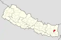 Lage des Distriktes Tehrathum (rot) in Nepal | |
| Basisdaten | |
| Staat | Nepal |
| Provinz | Provinz Nr. 1 |
| Sitz | Myanglung |
| Fläche | 679 km² |
| Einwohner | 101.577 (Volkszählung 2011) |
| Dichte | 150 Einwohner pro km² |
| ISO 3166-2 | NP-P1 |
| Webauftritt | ddctehrathum.gov.np |
Der Fluss Tamor bildet die östliche und südliche Distriktgrenze.
Der Distrikt hatte bei der Volkszählung 2001 113.111 Einwohner.[2][3]
Der Name bedeutet „Dreizehn Burgen“, die es im Gebiet der Limbu, dem im Distrikt ansässigen Volk, gegeben haben soll.
Verwaltungsgliederung
Städte (Munizipalitäten) im Distrikt Terhatum:
Gaunpalikas (Landgemeinden):
- Aathrai
- Chhathar
- Phedap
- Menchayayem
Weblinks
Einzelnachweise
- Schedule-4 States, and Districts to be included in the concerned States. – Nepal Law Commission. Abgerufen am 13. Dezember 2018 (englisch).
- Household and population by districts, Central Bureau of Statistics (CBS) Nepal (Memento vom 31. Juli 2013 im Internet Archive) (PDF; 2,1 MB)
- Central Bureau of Statistics, Census 2011: National Report (S. 51–52, Population Total und Area in Sq. Km). (Memento vom 18. April 2013 im Internet Archive) (PDF-Datei; 7,5 MB)
Achham | Arghakhanchi | Baglung | Baitadi | Bajhang | Bajura | Banke | Bara | Bardiya | Bhaktapur | Bhojpur | Chitwan | Dadeldhura | Dailekh | Dang Deukhuri | Darchula | Dhading | Dhankuta | Dhanusha | Dolakha | Dolpa | Doti | Gorkha | Gulmi | Humla | Ilam | Jajarkot | Jhapa | Jumla | Kabhrepalanchok | Kailali | Kalikot | Kanchanpur | Kapilbastu | Kaski | Kathmandu | Khotang | Lalitpur | Lamjung | Mahottari | Makwanpur | Manang | Morang | Mugu | Mustang | Myagdi | Nawalparasi (Bardaghat Susta East) | Nawalparasi (Bardaghat Susta West) | Nuwakot | Okhaldhunga | Palpa | Panchthar | Parbat | Parsa | Pyuthan | Ramechhap | Rasuwa | Rautahat | Rolpa | Rukum East | Rukum West | Rupandehi | Salyan | Sankhuwasabha | Saptari | Sarlahi | Sindhuli | Sindhupalchok | Siraha | Solukhumbu | Sunsari | Surkhet | Syangja | Tanahu | Taplejung | Terhathum | Udayapur