Sankhuwasabha
Der Distrikt Sankhuwasabha (Nepali सङ्खुवासभा जिल्ला) ist einer von 77 Distrikten in Nepal und gehört seit der Verfassung von 2015 zur Provinz Nr. 1.[1]
| सङ्खुवासभा जिल्ला Distrikt Sankhuwasabha | |
|---|---|
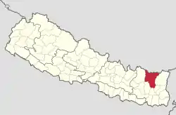 Lage des Distriktes Sankhuwasabha (rot) in Nepal | |
| Basisdaten | |
| Staat | Nepal |
| Hauptstadt | Khandbari |
| Fläche | 3480 km² |
| Einwohner | 158.742 (Volkszählung 2011) |
| Dichte | 46 Einwohner pro km² |
| ISO 3166-2 | NP-P1 |
| Webauftritt | ddcsankhuwasabha.gov.np |
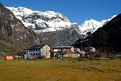 Yangle Kharka, ein Dorf in Sankhuwasabha | |
Bei der Volkszählung 2001 hatte er 159.203 Einwohner; im Jahre 2011 waren es 158.742.[2]
Der Distrikt ist geprägt vom tiefen Tal des Arun, einem der drei großen Flüsse Nepals, dem ein hohes Wasserkraftpotential zugeschrieben wird.
Im Distrikt lebende indigene Völker sind u. a. die Yakkhas, Lohorung, Kulung, Rai, Gurung und Limbu.
Verwaltungsgliederung
Städte im Distrikt Sankhuwasabha:
Gaunpalikas (Landgemeinden):
- Bhotkhola
- Chichila
- Makalu
- Sabhapokhari
- Silichong
Weblinks
Einzelnachweise
- Schedule-4 States, and Districts to be included in the concerned States. – Nepal Law Commission. Abgerufen am 13. Dezember 2018 (englisch).
- Central Bureau of Statistics, Census 2011: National Report (S. 51–52, Population Total und Area in Sq. Km). (Memento vom 18. April 2013 im Internet Archive) (PDF; 7,8 MB)
Achham | Arghakhanchi | Baglung | Baitadi | Bajhang | Bajura | Banke | Bara | Bardiya | Bhaktapur | Bhojpur | Chitwan | Dadeldhura | Dailekh | Dang Deukhuri | Darchula | Dhading | Dhankuta | Dhanusha | Dolakha | Dolpa | Doti | Gorkha | Gulmi | Humla | Ilam | Jajarkot | Jhapa | Jumla | Kabhrepalanchok | Kailali | Kalikot | Kanchanpur | Kapilbastu | Kaski | Kathmandu | Khotang | Lalitpur | Lamjung | Mahottari | Makwanpur | Manang | Morang | Mugu | Mustang | Myagdi | Nawalparasi (Bardaghat Susta East) | Nawalparasi (Bardaghat Susta West) | Nuwakot | Okhaldhunga | Palpa | Panchthar | Parbat | Parsa | Pyuthan | Ramechhap | Rasuwa | Rautahat | Rolpa | Rukum East | Rukum West | Rupandehi | Salyan | Sankhuwasabha | Saptari | Sarlahi | Sindhuli | Sindhupalchok | Siraha | Solukhumbu | Sunsari | Surkhet | Syangja | Tanahu | Taplejung | Terhathum | Udayapur