Palpa (Distrikt)
Der Distrikt Palpa (Nepali पाल्पा जिल्ला) ist einer der 77 Distrikte in Nepal mit Verwaltungssitz in Tansen.
| पाल्पा जिल्ला Distrikt Palpa | |
|---|---|
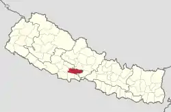
 Lage des Distriktes Palpa (rot) in Nepal | |
| Basisdaten | |
| Staat | Nepal |
| Provinz | Provinz Lumbini |
| Sitz | Tansen |
| Fläche | 1373 km² |
| Einwohner | 26.118 (Volkszählung 2011) |
| Dichte | 19 Einwohner pro km² |
| ISO 3166-2 | NP-P5 |
| Fläche und Einw. nach Volkszählung 2011 | |
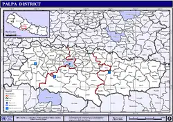
 VDC und Städte (blau) in Palpa | |

Verwaltungssitz Tansen
Der Distrikt gehört zur Provinz Lumbini im südlichen Nepal. Er hat eine Fläche von 1373 km² und hatte bei der Volkszählung 2001 268.558 Bewohner, im Jahre 2011 waren es 261.180.[1] Der Distrikt Palpa erstreckt sich südlich des Unterlaufs der Kali Gandaki.
Verwaltungsgliederung
Städte (Munizipalitäten) im Distrikt Palpa:
Village Development Committees (VDCs) im Distrikt Palpa:
- Archale
- Argali
- Bahadurpur
- Baldengadhi
- Bandi Pokhara
- Bhairabsthan
- Bhuwan Pokhari
- Birkot
- Boghapokharathok
- Boudhagumba
- Chappani
- Chhahara
- Chidipani
- Chirtungdhara
- Darlamdanda
- Deurali
- Devinagar
- Dobhan
- Fek
- Foksingkot
- Galdha
- Gothadi
- Heklang
- Humin
- Hungi
- Jalpa
- Jhadewa
- Jhirubas
- Juthapauwa
- Jyamire
- Kachal
- Kaseni
- Khanichhap
- Khanigau
- Khasyoli
- Khyaha
- Koldanda
- Kusumkhola
- Madanpokhara
- Mainadi
- Masyam
- Mityal
- Mujhung
- Narayanmatales
- Palung Mainadi
- Pipaldada
- Pokharathok
- Rahabas
- Ringneraha
- Rupse
- Sahalkot
- Satyawati
- Siddheshwor
- Siluwa
- Somadi
- Tahu
- Telgha
- Timurekha
- Wakamalang
- Yamgha
Weblinks
Commons: Distrikt Palpa – Sammlung von Bildern, Videos und Audiodateien
Einzelnachweise
- Central Bureau of Statistics, Census 2011: National Report (S. 51–52, Population Total und Area in Sq. Km). (Memento vom 18. April 2013 im Internet Archive) (PDF; 7,8 MB)
This article is issued from Wikipedia. The text is licensed under Creative Commons - Attribution - Sharealike. The authors of the article are listed here. Additional terms may apply for the media files, click on images to show image meta data.