Saint-Nicolas-la-Chapelle (Aube)
Saint-Nicolas-la-Chapelle ist eine französische Gemeinde mit 67 Einwohnern (Stand: 1. Januar 2019) im Département Aube in der Region Grand Est. Sie gehört zum Arrondissement Nogent-sur-Seine und zum gleichnamigen Kanton Nogent-sur-Seine.
| Saint-Nicolas-la-Chapelle | ||
|---|---|---|
| ||
| Staat | Frankreich | |
| Region | Grand Est | |
| Département (Nr.) | Aube (10) | |
| Arrondissement | Nogent-sur-Seine | |
| Kanton | Kanton Nogent-sur-Seine | |
| Gemeindeverband | Communauté de communes du Nogentais | |
| Koordinaten | 48° 32′ N, 3° 28′ O | |
| Höhe | 60–166 m | |
| Fläche | 11,60 km² | |
| Einwohner | 67 (1. Januar 2019) | |
| Bevölkerungsdichte | 6 Einw./km² | |
| Postleitzahl | 10400 | |
| INSEE-Code | 10355 | |
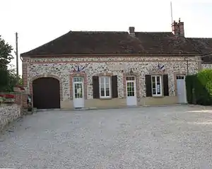 Die Mairie von Saint-Nicolas-la-Chapelle | ||

Lage
Das Gemeindegebiet wird vom Flüsschen Resson durchquert, einem rechten Zufluss der Seine.
Nachbargemeinden sind:
| Chalautre-la-Grande | La Saulsotte | |
| Le Mériot | .svg.png.webp) |
|
| Nogent-sur-Seine | Marnay-sur-Seine |
Bevölkerungsentwicklung
| Jahr | 1962 | 1968 | 1975 | 1982 | 1990 | 1999 | 2008 | 2016 |
|---|---|---|---|---|---|---|---|---|
| Einwohner | 88 | 70 | 68 | 70 | 61 | 79 | 77 | 63 |
| Quelle: Cassini und INSEE | ||||||||
This article is issued from Wikipedia. The text is licensed under Creative Commons - Attribution - Sharealike. The authors of the article are listed here. Additional terms may apply for the media files, click on images to show image meta data.