Saint-Baraing
Saint-Baraing ist eine französische Gemeinde im Département Jura in der Region Bourgogne-Franche-Comté. Sie gehört zum Arrondissement Dole und zum Kanton Tavaux.
| Saint-Baraing | ||
|---|---|---|
| ||
| Staat | Frankreich | |
| Region | Bourgogne-Franche-Comté | |
| Département (Nr.) | Jura (39) | |
| Arrondissement | Dole | |
| Kanton | Tavaux | |
| Gemeindeverband | Plaine Jurassienne | |
| Koordinaten | 46° 59′ N, 5° 26′ O | |
| Höhe | 187–217 m | |
| Fläche | 6,35 km² | |
| Einwohner | 260 (1. Januar 2019) | |
| Bevölkerungsdichte | 41 Einw./km² | |
| Postleitzahl | 39120 | |
| INSEE-Code | 39477 | |
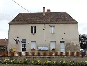 Mairie Saint-Baraing | ||

Geografie
Durch Saint-Baraing fließt der Orain. Die angrenzenden Gemeinden sind Rahon, Balaiseaux, Gatey, Chaussin und Champdivers. Der See Étang Servotte erstreckt sich über Saint-Baraing und Balaiseaux.
Bevölkerungsentwicklung
| Jahr | 1962 | 1968 | 1975 | 1982 | 1990 | 1999 | 2005 | 2017 | |
|---|---|---|---|---|---|---|---|---|---|
| Einwohner | 177 | 164 | 153 | 178 | 194 | 181 | 197 | 261 | |
| Quellen: Cassini und INSEE | |||||||||
Weblinks
Commons: Saint-Baraing – Sammlung von Bildern, Videos und Audiodateien
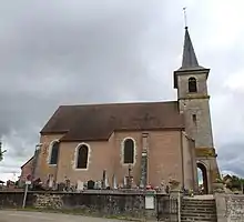
Kirche Saint-Bénigne
This article is issued from Wikipedia. The text is licensed under Creative Commons - Attribution - Sharealike. The authors of the article are listed here. Additional terms may apply for the media files, click on images to show image meta data.