Étrepigney
Étrepigney ist eine französische Gemeinde mit 427 Einwohnern (Stand 1. Januar 2019) im Département Jura in der Region Bourgogne-Franche-Comté. Sie gehört zum Arrondissement Dole und zum Kanton Mont-sous-Vaudrey. Die Bewohner nennen sich die Étrepignaciens.
| Étrepigney | ||
|---|---|---|

|
| |
| Staat | Frankreich | |
| Region | Bourgogne-Franche-Comté | |
| Département (Nr.) | Jura (39) | |
| Arrondissement | Dole | |
| Kanton | Mont-sous-Vaudrey | |
| Gemeindeverband | Jura Nord | |
| Koordinaten | 47° 8′ N, 5° 42′ O | |
| Höhe | 207–262 m | |
| Fläche | 15,64 km² | |
| Einwohner | 427 (1. Januar 2019) | |
| Bevölkerungsdichte | 27 Einw./km² | |
| Postleitzahl | 39700 | |
| INSEE-Code | 39218 | |
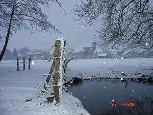
 Winterlandschaft bei Étrepigney | ||
Geografie
Der Fluss Doubs bildet im Norden die Gemeindegrenze. Die Siedlung wird im Norden von einem Bach namens Doulonne tangiert. Die Nachbargemeinden sind La Barre im Norden, Rans im Nordosten, Plumont im Osten, Chissey-sur-Loue im Südosten, Chatelay im Süden, Germigney im Südwesten, Our und La Bretenière im Westen sowie Orchamps im Nordwesten.
Bevölkerungsentwicklung
| Jahr | 1962 | 1968 | 1975 | 1982 | 1990 | 1999 | 2006 | 2017 | |
|---|---|---|---|---|---|---|---|---|---|
| Einwohner | 262 | 279 | 252 | 297 | 321 | 357 | 379 | 430 | |
| Quellen: Cassini und INSEE | |||||||||
.JPG.webp) Die Doulonne
Die Doulonne Der Doubs
 Museum
 Kirche Saint-Étienne
Weblinks
Commons: Étrepigney – Sammlung von Bildern, Videos und Audiodateien
This article is issued from Wikipedia. The text is licensed under Creative Commons - Attribution - Sharealike. The authors of the article are listed here. Additional terms may apply for the media files, click on images to show image meta data.
