Saint-Avit (Drôme)
Saint-Avit ist eine französische Gemeinde im Département Drôme. Saint-Avit gehört zum Arrondissement Valence und zum Kanton Drôme des collines (bis 2015: Kanton Saint-Vallier). Die Gemeinde hat 324 Einwohner (Stand: 1. Januar 2019), die Saint-Avitois genannt werden.
| Saint-Avit | ||
|---|---|---|
| ||
| Staat | Frankreich | |
| Region | Auvergne-Rhône-Alpes | |
| Département (Nr.) | Drôme (26) | |
| Arrondissement | Valence | |
| Kanton | Drôme des collines | |
| Gemeindeverband | Porte de DrômArdèche | |
| Koordinaten | 45° 12′ N, 4° 58′ O | |
| Höhe | 227–443 m | |
| Fläche | 9,03 km² | |
| Einwohner | 324 (1. Januar 2019) | |
| Bevölkerungsdichte | 36 Einw./km² | |
| Postleitzahl | 26330 | |
| INSEE-Code | 26293 | |
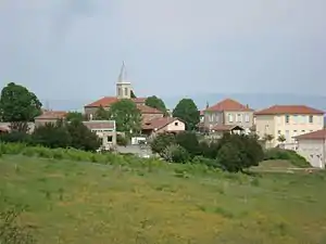
 Blick auf Saint-Avit | ||
Geographie
Saint-Avit liegt etwa 60 Kilometer westlich von Grenoble. Umgeben wird Saint-Avit von den Nachbargemeinden Châteauneuf-de-Galaure und Saint-Martin-d’Août im Norden, Tersanne im Osten und Nordosten, Bathernay im Osten und Südosten, Ratières im Süden, Claveyson im Südwesten sowie Saint-Jean-de-Galaure im Westen und Nordwesten.
Geschichte
1869 wurde Saint-Avit aus der heutigen Nachbarkommune Ratières herausgelöst und eigenständig.
Bevölkerungsentwicklung
| Jahr | 1911 | 1962 | 1968 | 1975 | 1982 | 1990 | 1999 | 2006 | 2013 |
|---|---|---|---|---|---|---|---|---|---|
| Einwohner | 419 | 311 | 276 | 240 | 231 | 212 | 242 | 300 | 296 |
| Quellen: Cassini und INSEE | |||||||||
Weblinks
Commons: Saint-Avit – Sammlung von Bildern, Videos und Audiodateien
This article is issued from Wikipedia. The text is licensed under Creative Commons - Attribution - Sharealike. The authors of the article are listed here. Additional terms may apply for the media files, click on images to show image meta data.
