Marcillac-Lanville
Marcillac-Lanville ist eine französische Gemeinde mit 492 Einwohnern (Stand 1. Januar 2019) im Département Charente in der Region Nouvelle-Aquitaine (vor 2016 Poitou-Charentes); sie gehört zum Arrondissement Cognac und zum Kanton Val de Nouère.
| Marcillac-Lanville | ||
|---|---|---|
| ||
| Staat | Frankreich | |
| Region | Nouvelle-Aquitaine | |
| Département (Nr.) | Charente (16) | |
| Arrondissement | Cognac | |
| Kanton | Val de Nouère | |
| Gemeindeverband | Rouillacais | |
| Koordinaten | 45° 51′ N, 0° 1′ O | |
| Höhe | 47–136 m | |
| Fläche | 18,52 km² | |
| Einwohner | 492 (1. Januar 2019) | |
| Bevölkerungsdichte | 27 Einw./km² | |
| Postleitzahl | 16140 | |
| INSEE-Code | 16207 | |
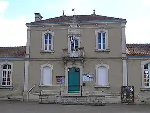 Rathaus (Mairie) von Marcillac-Lanville | ||

Geographie
Marcillac-Lanville liegt etwa 25 Kilometer nordnordwestlich von Angoulême. Umgeben wird Marcillac-Lanville von den Nachbargemeinden Aigre (mit Aigre und Villejésus) im Norden und Nordosten, Fouqueure im Nordosten, Ambérac im Osten, La Chapelle im Südosten, Genac-Bignac im Süden, Gourville im Südwesten sowie Mons im Westen und Nordwesten.
Bevölkerungsentwicklung
| 1962 | 1968 | 1975 | 1982 | 1990 | 1999 | 2006 | 2018 |
|---|---|---|---|---|---|---|---|
| 640 | 564 | 576 | 551 | 534 | 565 | 584 | 502 |
| Quellen: Cassini und INSEE | |||||||
Sehenswürdigkeiten
- Ruine des Priorats Notre-Dame von Lanville aus dem 12. Jahrhundert, Monument historique seit 1942, mit Kirche Saint-Michel
- Schloss Marcillac, ursprünglich als Festung im 9. Jahrhundert erbaut

Kirche Saint-Michel
This article is issued from Wikipedia. The text is licensed under Creative Commons - Attribution - Sharealike. The authors of the article are listed here. Additional terms may apply for the media files, click on images to show image meta data.