La Chapelle-Saint-Jean
La Chapelle-Saint-Jean ist eine französische Gemeinde mit 91 Einwohnern (Stand 1. Januar 2019) im Département Dordogne in der Region Nouvelle-Aquitaine (vor 2016 Aquitaine). Sie gehört zum Arrondissement Sarlat-la-Canéda (bis 2017 Périgueux) und zum seit 2015 bestehenden Kanton Le Haut-Périgord noir (bis 2015 Hautefort). Die Bewohner nennen sich Chapelais.
| La Chapelle-Saint-Jean | ||
|---|---|---|
| ||
| Staat | Frankreich | |
| Region | Nouvelle-Aquitaine | |
| Département (Nr.) | Dordogne (24) | |
| Arrondissement | Sarlat-la-Canéda | |
| Kanton | Le Haut-Périgord noir | |
| Gemeindeverband | Terrassonnais en Périgord Noir Thenon Hautefort | |
| Koordinaten | 45° 12′ N, 1° 10′ O | |
| Höhe | 204–356 m | |
| Fläche | 3,89 km² | |
| Einwohner | 91 (1. Januar 2019) | |
| Bevölkerungsdichte | 23 Einw./km² | |
| Postleitzahl | 24390 | |
| INSEE-Code | 24113 | |
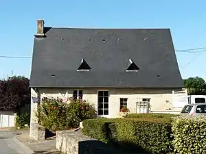 Rathaus (Mairie) von La Chapelle-Saint-Jean | ||

Geografie
La Chapelle-Saint-Jean liegt etwa 37 Kilometer östlich von Périgueux. Nachbargemeinden sind Nailhac im Norden und Westen, Châtres im Osten sowie Saint-Rabier im Süden und Westen.
Bevölkerungsentwicklung
| Jahr | 1962 | 1968 | 1975 | 1982 | 1990 | 1999 | 2006 | 2013 |
|---|---|---|---|---|---|---|---|---|
| Einwohner | 98 | 67 | 62 | 74 | 69 | 62 | 75 | 94 |
| Quelle: Cassini und INSEE | ||||||||
Sehenswürdigkeiten
- Kirche Saint-Jean-Baptiste
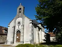
Kirche Saint-Jean-Baptiste
This article is issued from Wikipedia. The text is licensed under Creative Commons - Attribution - Sharealike. The authors of the article are listed here. Additional terms may apply for the media files, click on images to show image meta data.