Ercuis
| Ercuis | ||
|---|---|---|
|
| |
| Staat | Frankreich | |
| Region | Hauts-de-France | |
| Département (Nr.) | Oise (60) | |
| Arrondissement | Senlis | |
| Kanton | Méru | |
| Gemeindeverband | Thelloise | |
| Koordinaten | 49° 14′ N, 2° 18′ O | |
| Höhe | 84–157 m | |
| Fläche | 4,41 km² | |
| Einwohner | 1.606 (1. Januar 2019) | |
| Bevölkerungsdichte | 364 Einw./km² | |
| Postleitzahl | 60530 | |
| INSEE-Code | 60212 | |
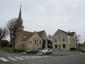 Kirche und Rathaus (Mairie) von Ercuis | ||

Ercuis ist eine französische Gemeinde mit 1.606 Einwohnern (Stand: 1. Januar 2019) im Département Oise in der Region Hauts-de-France. Die Gemeinde liegt im Arrondissement Senlis und ist Teil der Communauté de communes Thelloise und des Kantons Méru (bis 2015: Kanton Neuilly-en-Thelle).
Geographie
Ercuis liegt in den Pays de Thelle, etwa 20 Kilometer westnordwestlich von Senlis. Umgeben wird Ercuis von den Nachbargemeinden Neuilly-en-Thelle im Norden und Westen, Cires-lès-Mello im Norden und Nordosten, Blaincourt-lès-Précy im Osten und Südosten sowie Crouy-en-Thelle im Süden.
Bevölkerungsentwicklung
| 1962 | 1968 | 1975 | 1982 | 1990 | 1999 | 2006 | 2013 | |
|---|---|---|---|---|---|---|---|---|
| 640 | 664 | 743 | 985 | 1262 | 1566 | 1461 | 1466 | |
| Quelle: Cassini und INSEE | ||||||||
Sehenswürdigkeiten
- Kirche Saint-Nicolas
- Schloss Ercuis
- Gutshof Le Thelle
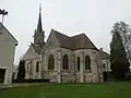 Kirche Saint-Nicolas
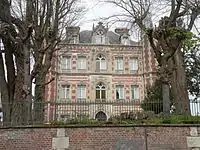 Schloss
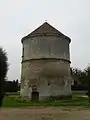 Turm des Gutshofs Le Thelle
Persönlichkeiten
- Guillaume d’Ercuis (um 1255–1314/1315), königlicher Notar und Almosenier
Weblinks
Commons: Ercuis – Sammlung von Bildern, Videos und Audiodateien
- Monuments historiques (Objekte) in Ercuis in der Base Palissy des französischen Kultusministeriums
This article is issued from Wikipedia. The text is licensed under Creative Commons - Attribution - Sharealike. The authors of the article are listed here. Additional terms may apply for the media files, click on images to show image meta data.