Condécourt
Condécourt ist eine französische Gemeinde mit 548 Einwohnern (Stand: 1. Januar 2019) im Département Val-d’Oise in der Region Île-de-France; sie gehört zum Arrondissement Pontoise und zum Kanton Vauréal (bis 2015: Kanton Vigny).
| Condécourt | ||
|---|---|---|
| ||
| Staat | Frankreich | |
| Region | Île-de-France | |
| Département (Nr.) | Val-d’Oise (95) | |
| Arrondissement | Pontoise | |
| Kanton | Vauréal | |
| Gemeindeverband | Vexin Centre | |
| Koordinaten | 49° 3′ N, 1° 57′ O | |
| Höhe | 37–127 m | |
| Fläche | 6,98 km² | |
| Einwohner | 548 (1. Januar 2019) | |
| Bevölkerungsdichte | 79 Einw./km² | |
| Postleitzahl | 95450 | |
| INSEE-Code | 95170 | |
| Website | https://condecourt.fr/ | |
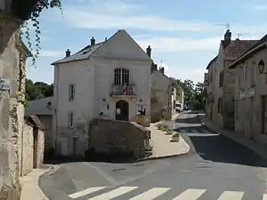
 Rathaus (Mairie) von Condécourt | ||
Geographie
Condécourt liegt in der Landschaft Vexin français, etwa 35 Kilometer nordwestlich von Paris. Umgeben wird Condécourt von den Nachbargemeinden Longuesse im Norden, Sagy im Osten und Nordosten, Menucourt im Osten und Südosten, Évecquemont im Süden, Tessancourt-sur-Aubette im Westen und Südwesten sowie Gaillon-sur-Montcient im Westen. Der Ort liegt am Ufer des Flusses Aubette. Das gesamte Gemeindegebiet gehört zum Regionalen Naturpark Vexin français.
Bevölkerungsentwicklung
| Jahr | 1962 | 1968 | 1975 | 1982 | 1990 | 1999 | 2006 | 2013 |
| Einwohner | 275 | 341 | 378 | 511 | 532 | 486 | 531 | 576 |
| Quelle: Cassini und INSEE | ||||||||
Sehenswürdigkeiten
Siehe auch: Liste der Monuments historiques in Condécourt
- Kirche Saint-Pierre-ès-Liens, Ende des 11. Jahrhunderts erbaut, Monument historique seit 1925
- Schloss Villette mit Garten, seit 1942 Monument historique
- Waschhaus

Kirche Saint-Pierre-ès-Liens
Literatur
- Le Patrimoine des Communes du Val-d'Oise. Flohic Éditions, Band 2, Paris 1999, ISBN 2-84234-056-6, S. 992–993.
This article is issued from Wikipedia. The text is licensed under Creative Commons - Attribution - Sharealike. The authors of the article are listed here. Additional terms may apply for the media files, click on images to show image meta data.
