Chénérailles
Chénérailles ist eine Gemeinde in Frankreich. Sie war der Hauptort (Chef-lieu) des Kantons Chénérailles und wurde 2015 zum Kanton Gouzon geschlagen. Sie gehört zur Region Nouvelle-Aquitaine, zum Département Creuse und zum Arrondissement Aubusson. Sie grenzt im Norden an Saint-Dizier-la-Tour, im Osten an Saint-Chabrais, im Süden an Issoudun-Létrieix und im Westen an Saint-Pardoux-les-Cards. In der Gemeindegemarkung liegen sämtliche kleine Seen, darunter der Étang des Brochets.
| Chénérailles | ||
|---|---|---|
|
| |
| Staat | Frankreich | |
| Region | Nouvelle-Aquitaine | |
| Département (Nr.) | Creuse (23) | |
| Arrondissement | Aubusson | |
| Kanton | Gouzon | |
| Gemeindeverband | Marche et Combraille en Aquitaine | |
| Koordinaten | 46° 7′ N, 2° 11′ O | |
| Höhe | 487–553 m | |
| Fläche | 7,80 km² | |
| Einwohner | 755 (1. Januar 2019) | |
| Bevölkerungsdichte | 97 Einw./km² | |
| Postleitzahl | 23130 | |
| INSEE-Code | 23061 | |
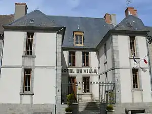 Rathaus Chénérailles | ||

Bevölkerungsentwicklung
| Jahr | 1962 | 1968 | 1975 | 1982 | 1990 | 1999 | 2008 | 2013 |
|---|---|---|---|---|---|---|---|---|
| Einwohner | 770 | 729 | 674 | 685 | 794 | 759 | 736 | 766 |
This article is issued from Wikipedia. The text is licensed under Creative Commons - Attribution - Sharealike. The authors of the article are listed here. Additional terms may apply for the media files, click on images to show image meta data.