Saint-Stail
Saint-Stail ist eine französische Gemeinde mit 72 Einwohnern (Stand 1. Januar 2019) im Département Vosges in der Region Grand Est (bis 2015 Lothringen). Sie gehört zum Kanton Raon-l’Étape im Arrondissement Saint-Dié-des-Vosges. Die Bewohner nennen sich Stéphanois(es).
| Saint-Stail | ||
|---|---|---|
| ||
| Staat | Frankreich | |
| Region | Grand Est | |
| Département (Nr.) | Vosges (88) | |
| Arrondissement | Saint-Dié-des-Vosges | |
| Kanton | Raon-l’Étape | |
| Gemeindeverband | Saint-Dié-des-Vosges | |
| Koordinaten | 48° 23′ N, 7° 4′ O | |
| Höhe | 550–802 m | |
| Fläche | 6,17 km² | |
| Einwohner | 72 (1. Januar 2019) | |
| Bevölkerungsdichte | 12 Einw./km² | |
| Postleitzahl | 88210 | |
| INSEE-Code | 88436 | |
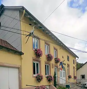 Mairie Saint-Stail | ||

Demografie
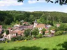
Blick auf Saint-Stail
Die Gemeinde Saint-Stail liegt 560 m über dem Meer nahe dem Vogesenkamm und dem Col du Hantz. Sie grenzt im Nordwesten an Le Vermont, im Nordosten an Saulxures, im Osten an Bourg-Bruche, im Südosten an Saales und im Südwesten an Grandrupt.
Bevölkerungsentwicklung
| Jahr | 1962 | 1968 | 1975 | 1982 | 1990 | 1999 | 2008 | 2019 |
|---|---|---|---|---|---|---|---|---|
| Einwohner | 74 | 66 | 58 | 62 | 59 | 52 | 77 | 72 |
Sehenswürdigkeiten
- Kirche Saint-Étienne

Kirche Saint-Étienne
Weblinks
Commons: Saint-Stail – Sammlung von Bildern, Videos und Audiodateien
This article is issued from Wikipedia. The text is licensed under Creative Commons - Attribution - Sharealike. The authors of the article are listed here. Additional terms may apply for the media files, click on images to show image meta data.