Le Thour
Le Thour ist eine französische Gemeinde mit 378 Einwohnern (Stand 1. Januar 2019) im Département Ardennes in der Region Grand Est. Sie gehört zum Arrondissement Rethel, zum Kanton Château-Porcien und zum Gemeindeverband Pays Rethélois.
| Le Thour | ||
|---|---|---|
| ||
| Staat | Frankreich | |
| Region | Grand Est | |
| Département (Nr.) | Ardennes (08) | |
| Arrondissement | Rethel | |
| Kanton | Château-Porcien | |
| Gemeindeverband | Pays Rethélois | |
| Koordinaten | 49° 32′ N, 4° 5′ O | |
| Höhe | 70–129 m | |
| Fläche | 16,60 km² | |
| Einwohner | 378 (1. Januar 2019) | |
| Bevölkerungsdichte | 23 Einw./km² | |
| Postleitzahl | 08190 | |
| INSEE-Code | 08451 | |
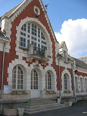 Rathaus (Mairie) und Schule von Le Thour | ||

Geografie
Das Gemeindegebiet wird vom Fluss Barres durchquert. Umgeben wird Le Thour von den Nachbargemeinden Saint-Quentin-le-Petit im Norden, Banogne-Recouvrance im Nordosten, Saint-Germainmont im Südosten, Villers-devant-le-Thour im Süden, Lor im Westen sowie Nizy-le-Comte im Nordwesten.
Bevölkerungsentwicklung
| Jahr | 1962 | 1968 | 1975 | 1982 | 1990 | 1999 | 2009 | 2019 |
| Einwohner | 312 | 377 | 333 | 303 | 351 | 317 | 330 | 378 |
| Quellen: Cassini und INSEE | ||||||||
Sehenswürdigkeiten
- Kirche Saint-Nicolas
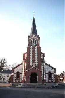
Kirche Saint-Nicolas
This article is issued from Wikipedia. The text is licensed under Creative Commons - Attribution - Sharealike. The authors of the article are listed here. Additional terms may apply for the media files, click on images to show image meta data.