Kanton Mitry-Mory
Der Kanton Mitry-Mory ist ein französischer Wahlkreis im Arrondissement Meaux im Département Seine-et-Marne und in der Region Île-de-France; sein Hauptort ist Mitry-Mory, Vertreter im Generalrat des Départements ist seit 1994, zuletzt wiedergewählt 2008, Jean-Pierre Bontoux (PCF).
| Kanton Mitry-Mory | |
|---|---|
| Region | Île-de-France |
| Département | Seine-et-Marne |
| Arrondissement | Meaux |
| Hauptort | Mitry-Mory |
| Einwohner | 63.350 (1. Jan. 2019) |
| Bevölkerungsdichte | 363 Einw./km² |
| Fläche | 174,67 km² |
| Gemeinden | 19 |
| INSEE-Code | 7712 |
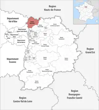 Lage des Kantons Mitry-Mory im Département Seine-et-Marne | |
Gemeinden
Der Kanton besteht aus 19 Gemeinden mit insgesamt 63.350 Einwohnern (Stand: 1. Januar 2019) auf einer Gesamtfläche von 174,67 km²:
| Gemeinde | Einwohner 1. Januar 2019 |
Fläche km² |
Dichte Einw./km² |
Code INSEE |
Postleitzahl |
|---|---|---|---|---|---|
| Compans | 815 | 5,32 | 153 | 77123 | 77290 |
| Dammartin-en-Goële | 10.355 | 9,00 | 1.151 | 77153 | 77230 |
| Juilly | 2.003 | 7,74 | 259 | 77241 | 77230 |
| Le Mesnil-Amelot | 1.068 | 9,83 | 109 | 77291 | 77990 |
| Longperrier | 2.331 | 4,65 | 501 | 77259 | 77230 |
| Marchémoret | 583 | 7,08 | 82 | 77273 | 77230 |
| Mauregard | 361 | 8,73 | 41 | 77282 | 77990 |
| Mitry-Mory | 20.648 | 29,94 | 690 | 77294 | 77290 |
| Montgé-en-Goële | 743 | 11,49 | 65 | 77308 | 77230 |
| Moussy-le-Neuf | 3.160 | 14,85 | 213 | 77322 | 77230 |
| Moussy-le-Vieux | 1.477 | 7,21 | 205 | 77323 | 77230 |
| Nantouillet | 286 | 5,16 | 55 | 77332 | 77230 |
| Othis | 6.725 | 13,03 | 516 | 77349 | 77280 |
| Rouvres | 910 | 4,16 | 219 | 77392 | 77230 |
| Saint-Mard | 3.875 | 6,25 | 620 | 77420 | 77230 |
| Saint-Pathus | 6.110 | 5,35 | 1.142 | 77430 | 77178 |
| Thieux | 872 | 12,02 | 73 | 77462 | 77230 |
| Villeneuve-sous-Dammartin | 645 | 7,57 | 85 | 77511 | 77230 |
| Vinantes | 383 | 5,29 | 72 | 77525 | 77230 |
| Kanton Mitry-Mory | 63.350 | 174,67 | 363 | 7712 | – |
Bis zur Neuordnung bestand der Kanton Claye-Souilly aus den 13 Gemeinden Charmentray, Charny, Compans, Fresnes-sur-Marne, Gressy, Iverny, Messy, Mitry-Mory, Nantouillet, Le Plessis-aux-Bois, Précy-sur-Marne, Saint-Mesmes und Villeroy. Sein Zuschnitt entsprach einer Fläche von 101,67 km2.
Bevölkerungsentwicklung
| 1968 | 1975 | 1982 | 1990 | 1999 | 2006 |
|---|---|---|---|---|---|
| 16 266 | 17 649 | 17 342 | 20 792 | 23 520 | 25 661 |
This article is issued from Wikipedia. The text is licensed under Creative Commons - Attribution - Sharealike. The authors of the article are listed here. Additional terms may apply for the media files, click on images to show image meta data.