Coutevroult
Coutevroult ist eine französische Gemeinde im Département Seine-et-Marne in der Region Île-de-France. Sie gehört zum Kanton Serris (bis 2015 Kanton Crécy-la-Chapelle) im Arrondissement Meaux. Die Bewohner nennen sich Coutevroultois.
| Coutevroult | ||
|---|---|---|
| ||
| Staat | Frankreich | |
| Region | Île-de-France | |
| Département (Nr.) | Seine-et-Marne (77) | |
| Arrondissement | Meaux | |
| Kanton | Serris | |
| Gemeindeverband | Coulommiers Pays de Brie | |
| Koordinaten | 48° 52′ N, 2° 51′ O | |
| Höhe | 47–142 m | |
| Fläche | 7,93 km² | |
| Einwohner | 1.167 (1. Januar 2019) | |
| Bevölkerungsdichte | 147 Einw./km² | |
| Postleitzahl | 77580 | |
| INSEE-Code | 77141 | |
| Website | http://mairie-coutevroult.fr/ | |
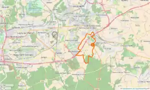 Lageplan | ||

Geografie
In Coutevroult gibt es eine Anschlussstelle an die Autoroute A4. Im Nordosten verläuft die Gemeindegrenze unmittelbar am Fluss Grand Morin. Auf der anderen Seite des Fließgewässers liegt Couilly-Pont-aux-Dames, eine Gemeinde, die Coutevroult nicht berührt. Die weiteren Nachbargemeinden sind Saint-Germain-sur-Morin im Nordwesten und im Norden, Villiers-sur-Morin im Osten, Villeneuve-le-Comte im Süden und Bailly-Romainvilliers im Südwesten.
Bevölkerungsentwicklung
| Jahr | 1962 | 1968 | 1975 | 1982 | 1990 | 1999 | 2008 | 2014 |
|---|---|---|---|---|---|---|---|---|
| Einwohner | 245 | 278 | 339 | 396 | 498 | 536 | 853 | 1.070 |
Sehenswürdigkeiten
- Kirche Saint-Jean-Baptiste (siehe auch: Liste der Monuments historiques in Coutevroult)
Literatur
- Le Patrimoine des Communes de la Seine-et-Marne. Flohic Editions, Band 1, Paris 2001, ISBN 2-84234-100-7, S. 358–359.
Weblinks
Commons: Coutevroult – Sammlung von Bildern, Videos und Audiodateien
- Coutevroult bei annuaire-mairie.fr (französisch)
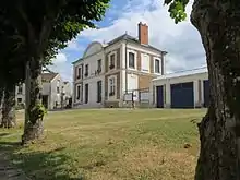
Mairie (Rathaus)
This article is issued from Wikipedia. The text is licensed under Creative Commons - Attribution - Sharealike. The authors of the article are listed here. Additional terms may apply for the media files, click on images to show image meta data.