Col de Montvoie
Der Col de Montvoie (früher auch: Col des Chainions) ist ein Pass im Schweizer Kanton Jura in der Gemeinde Fontenais zwischen Pruntrut (Schweiz) und Glère (Frankreich). Der Pass verbindet die Ajoie mit dem Doubstal. Die Passhöhe liegt auf 858 m ü. M. am Westfuss des Hügels «Les Chainions» (909 m) und durchschneidet die Lomontkette.[1][2]
| Col de Montvoie | |||
|---|---|---|---|
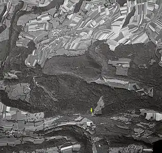 Col de Montvoie, Passhöhe Col de Montvoie, Passhöhe | |||
| Himmelsrichtung | Nord | Südwest | |
| Passhöhe | 858 m ü. M. | ||
| Region | Kanton Jura | Region Bourgogne-Franche-Comté | |
| Wasserscheide | Allaine, Doubs | Doubs | |
| Talorte | Pruntrut | Glère | |
| Ausbau | Passstrasse | ||
| Gebirge | Jura | ||
| Profil | |||
| Ø-Steigung | 4,6 % (415 m / 9 km) | 4,1 % (447 m / 11 km) | |
| Karte (Jura) | |||
| |||
| Koordinaten | 570752 / 246655 | ||
Weblinks
Einzelnachweise
Ächerli • Agites • Aiguillon • Albis • Albula • Balmberg • Benkerjoch • Bernina • Böhler • Bözberg • Breitehöchi • Brünig • Buechenegg • Bürersteig • Chall • Challhöchi • Champex • Chasseral • Chatzenstrick • Chilchzimmersattel • Croix • Croix • Croix de Coeur • Eichhöhe • Étroits • Etzelpass • Flüela • Forclaz • Furka • Ghöch • Givrine • Glas • Glaubenberg • Glaubenbielen • Gottschalkenberg • Grimsel • Grosse Scheidegg • Grosser St. Bernhard • Gurnigel • Haggenegg • Hahnenmoos • Heitersberg • Hilferen • Hirzel • Hirzel Höhi • Hulftegg • Ibergeregg • Jaman • Jaun • Julier • Kerenzerberg • Klausen • Kunkels • Lein • Lenzerheide • Livigno • Lukmanier • Maloja • Marchairuz • Mollendruz • Mont Crosin • Monte Ceneri • Mont d'Orzeires • Montvoie • Morgins • Mosses • Mutschellen • Neggia • Nufenen • Oberalp • Oberer Hauenstein • Oberricken • Ofen • Orn • Passwang • Pierre Pertuis • Pillon • Planches • Pontins • Pragel • Randenüberfahrt • Rangiers • Raten • Rengg • Ricken • Roches • Ruppen • Rüsler • Saanenmöser • Salhöhe • San Bernardino • Sanetsch • Santelhöchi • Sattel • Sattelegg • Schafmatt • Schallenberg • Schelten • Schönau • Schufelberger Egg • Schwägalp • Schwarzenbühl • Siblingerhöhe • Simplon • Splügen • St. Anton • St. Gotthard • St. Luzisteig • Staffelegg • Stoss • Susten • Tourne • Tronc • Umbrail • Unterer Hauenstein • Vorder Höhi • Vue des Alpes • Wasserfluh • Weissenstein • Wildhaus • Wissegg • Wolfgang