Châtelus (Allier)
Châtelus ist eine französische Gemeinde mit 104 Einwohnern (Stand: 1. Januar 2019) im Département Allier in der Region Auvergne-Rhône-Alpes (bis 2015 Auvergne). Sie gehört zum Arrondissement Vichy und zum Kanton Lapalisse.
| Châtelus | ||
|---|---|---|
.svg.png.webp)
|
| |
| Staat | Frankreich | |
| Region | Auvergne-Rhône-Alpes | |
| Département (Nr.) | Allier (03) | |
| Arrondissement | Vichy | |
| Kanton | Lapalisse | |
| Gemeindeverband | Vichy Communauté | |
| Koordinaten | 46° 12′ N, 3° 44′ O | |
| Höhe | 315–505 m | |
| Fläche | 6,53 km² | |
| Einwohner | 104 (1. Januar 2019) | |
| Bevölkerungsdichte | 16 Einw./km² | |
| Postleitzahl | 03120 | |
| INSEE-Code | 03068 | |
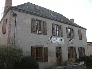 Rathaus (Mairie) von Châtelus | ||

Geographie
Châtelus liegt etwa 25 Kilometer ostnordöstlich von Vichy. Die Nachbargemeinden von Châtelus sind Droiturier im Norden, Saint-Martin-d’Estréaux im Osten, Arfeuilles im Süden sowie Le Breuil im Westen.
Bevölkerungsentwicklung
| Jahr | 1962 | 1968 | 1975 | 1982 | 1990 | 1999 | 2006 | 2011 | 2016 |
| Einwohner | 189 | 183 | 194 | 169 | 140 | 132 | 134 | 127 | 112 |
| Quellen: Cassini und INSEE | |||||||||
Sehenswürdigkeiten

Kirche Saint-Cyr
- Kirche Saint-Cyr
- Schulmuseum
Literatur
- Le Patrimoine des Communes de l’Allier. Flohic Editions, Band 1, Paris 1999, ISBN 2-84234-053-1, S. 543–545.
This article is issued from Wikipedia. The text is licensed under Creative Commons - Attribution - Sharealike. The authors of the article are listed here. Additional terms may apply for the media files, click on images to show image meta data.