Campoo de Enmedio
Campoo de Enmedio ist eine Gemeinde in der spanischen Autonomen Region Kantabrien. In der Gemeinde befinden sich die Überreste der Stadt Juliobriga (Spanisch: Julióbriga), welche das wichtigste städtische Zentrum im römischen Kantabrien war.
| Gemeinde Campoo de Enmedio | |||
|---|---|---|---|
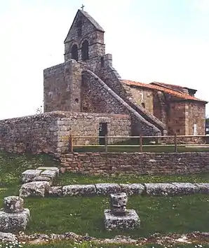 Kirche María de Retortillo | |||
| Wappen | Karte von Spanien | ||
.svg.png.webp) |
| ||
| Basisdaten | |||
| Autonome Gemeinschaft: | |||
| Koordinaten | 42° 59′ N, 4° 9′ W | ||
| Fläche: | 91,06 km² | ||
| Einwohner: | 3.714 (1. Jan. 2019)[1] | ||
| Bevölkerungsdichte: | 40,79 Einw./km² | ||
| Gemeindenummer (INE): | 39027 | ||
| Verwaltung | |||
| Website: | www.campoodeenmedio.es | ||
| Lage der Gemeinde | |||
_Mapa.svg.png.webp) | |||

Orte
- Aldueso
- Aradillos
- Bolmir
- Cañeda
- Celada Marlantes
- Cervatos
- Fombellida
- Fontecha
- Fresno del Río
- Horna de Ebro
- Matamorosa (Hauptstadt)
- Morancas
- Nestares
- Requejo
- Retortillo
- Villaescusa
Bevölkerungsentwicklung
| 1842 | 1900 | 1950 | 1981 | 1991 | 2001 | 2011 |
|---|---|---|---|---|---|---|
| 1075 | 2725 | 4605 | 4162 | 3867 | 3928 | 3805 |
Weblinks
Einzelnachweise
- Cifras oficiales de población resultantes de la revisión del Padrón municipal a 1 de enero. Bevölkerungsstatistiken des Instituto Nacional de Estadística (Bevölkerungsfortschreibung).
Alfoz de Lloredo | Ampuero | Anievas | Arenas de Iguña | Argoños | Arnuero | Arredondo | El Astillero | Bárcena de Cicero | Bárcena de Pie de Concha | Bareyo | Cabezón de la Sal | Cabezón de Liébana | Cabuérniga | Camaleño | Camargo | Campoo de Enmedio | Campoo de Yuso | Cartes | Castañeda | Castro Urdiales | Cieza | Cillorigo de Liébana | Colindres | Comillas | Los Corrales de Buelna | Corvera de Toranzo | Entrambasaguas | Escalante | Guriezo | Hazas de Cesto | Hermandad de Campoo de Suso | Herrerías | Lamasón | Laredo | Liendo | Liérganes | Limpias | Luena | Marina de Cudeyo | Mazcuerras | Medio Cudeyo | Meruelo | Miengo | Miera | Molledo | Noja | Penagos | Peñarrubia | Pesaguero | Pesquera | Piélagos | Polaciones | Polanco | Potes | Puente Viesgo | Ramales de la Victoria | Rasines | Reinosa | Reocín | Ribamontán al Mar | Ribamontán al Monte | Rionansa | Riotuerto | Las Rozas de Valdearroyo | Ruente | Ruesga | Ruiloba | San Felices de Buelna | San Miguel de Aguayo | San Pedro del Romeral | San Roque de Riomiera | San Vicente de la Barquera | Santa Cruz de Bezana | Santa María de Cayón | Santander | Santillana del Mar | Santiurde de Reinosa | Santiurde de Toranzo | Santoña | Saro | Selaya | Soba | Solórzano | Suances | Los Tojos | Torrelavega | Tresviso | Tudanca | Udías | Val de San Vicente | Valdáliga | Valdeolea | Valdeprado del Río | Valderredible | Valle de Villaverde | Vega de Liébana | Vega de Pas | Villacarriedo | Villaescusa | Villafufre | Voto