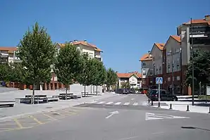
Santa Cruz de Bezana
Santa Cruz de Bezana ist eine Gemeinde in der spanischen Autonomen Region Kantabrien. Sie liegt am Kantabrischen Meer im Norden des Landes und verfügt über Strände.
| Gemeinde Santa Cruz de Bezana | |||
|---|---|---|---|
 | |||
| Wappen | Karte von Spanien | ||
 |
| ||
| Basisdaten | |||
| Autonome Gemeinschaft: | |||
| Koordinaten | 43° 27′ N, 3° 54′ W | ||
| Fläche: | 17,26 km² | ||
| Einwohner: | 13.095 (1. Jan. 2019)[1] | ||
| Bevölkerungsdichte: | 758,69 Einw./km² | ||
| Gemeindenummer (INE): | 39073 | ||
| Verwaltung | |||
| Website: | www.aytobezana.com/portal/ | ||
| Lage der Gemeinde | |||
_Mapa.svg.png.webp) | |||

Orte
- Azoños
- Maoño
- Mompía
- Prezanes
- Sancibrián
- Bezana (Hauptstadt)
- Soto de la Marina
Bevölkerungsentwicklung
| 1900 | 1910 | 1920 | 1930 | 1940 | 1950 | 1960 | 1970 | 1980 | 1990 | 2000 | 2007 | 2012 |
|---|---|---|---|---|---|---|---|---|---|---|---|---|
| 2.052 | 2.298 | 2.548 | 2.916 | 2.939 | 3.124 | 3.484 | 3.397 | 3.651 | 4.396 | 7.890 | 10.463 | 12.154 |
| Quelle: INE | ||||||||||||
Partnerstädte
Weblinks
Einzelnachweise
- Cifras oficiales de población resultantes de la revisión del Padrón municipal a 1 de enero. Bevölkerungsstatistiken des Instituto Nacional de Estadística (Bevölkerungsfortschreibung).
Alfoz de Lloredo | Ampuero | Anievas | Arenas de Iguña | Argoños | Arnuero | Arredondo | El Astillero | Bárcena de Cicero | Bárcena de Pie de Concha | Bareyo | Cabezón de la Sal | Cabezón de Liébana | Cabuérniga | Camaleño | Camargo | Campoo de Enmedio | Campoo de Yuso | Cartes | Castañeda | Castro Urdiales | Cieza | Cillorigo de Liébana | Colindres | Comillas | Los Corrales de Buelna | Corvera de Toranzo | Entrambasaguas | Escalante | Guriezo | Hazas de Cesto | Hermandad de Campoo de Suso | Herrerías | Lamasón | Laredo | Liendo | Liérganes | Limpias | Luena | Marina de Cudeyo | Mazcuerras | Medio Cudeyo | Meruelo | Miengo | Miera | Molledo | Noja | Penagos | Peñarrubia | Pesaguero | Pesquera | Piélagos | Polaciones | Polanco | Potes | Puente Viesgo | Ramales de la Victoria | Rasines | Reinosa | Reocín | Ribamontán al Mar | Ribamontán al Monte | Rionansa | Riotuerto | Las Rozas de Valdearroyo | Ruente | Ruesga | Ruiloba | San Felices de Buelna | San Miguel de Aguayo | San Pedro del Romeral | San Roque de Riomiera | San Vicente de la Barquera | Santa Cruz de Bezana | Santa María de Cayón | Santander | Santillana del Mar | Santiurde de Reinosa | Santiurde de Toranzo | Santoña | Saro | Selaya | Soba | Solórzano | Suances | Los Tojos | Torrelavega | Tresviso | Tudanca | Udías | Val de San Vicente | Valdáliga | Valdeolea | Valdeprado del Río | Valderredible | Valle de Villaverde | Vega de Liébana | Vega de Pas | Villacarriedo | Villaescusa | Villafufre | Voto