Buxières-d’Aillac
Buxières-d’Aillac ist eine französische Gemeinde mit 244 Einwohnern (Stand: 1. Januar 2019) im Département Indre in der Region Centre-Val de Loire; sie gehört zum Arrondissement La Châtre und zum Kanton Neuvy-Saint-Sépulchre (bis 2015: Kanton Ardentes). Die Einwohner werden Buxiérois genannt.
| Buxières-d’Aillac | ||
|---|---|---|
| ||
| Staat | Frankreich | |
| Region | Centre-Val de Loire | |
| Département (Nr.) | Indre (36) | |
| Arrondissement | La Châtre | |
| Kanton | Neuvy-Saint-Sépulchre | |
| Gemeindeverband | Val de Bouzanne | |
| Koordinaten | 46° 38′ N, 1° 45′ O | |
| Höhe | 155–222 m | |
| Fläche | 26,11 km² | |
| Einwohner | 244 (1. Januar 2019) | |
| Bevölkerungsdichte | 9 Einw./km² | |
| Postleitzahl | 36230 | |
| INSEE-Code | 36030 | |
| Website | https://mairiebuxieresdail.wixsite.com/buxieres-d-aillac | |
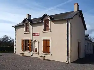 Rathaus (Mairie) von Buxières-d’Aillac | ||

Geographie
Buxières-d’Aillac liegt etwa 19 Kilometer südsüdöstlich von Châteauroux am Fluss Auzon. Umgeben wird Buxières-d’Aillac von den Nachbargemeinden Jeu-les-Bois im Norden und Nordosten, Lys-Saint-Georges im Osten, Neuvy-Saint-Sépulchre im Südosten, Gournay im Süden, Bouesse im Westen und Südwesten sowie Arthon im Nordwesten.
Bevölkerungsentwicklung
| Jahr | 1962 | 1968 | 1975 | 1982 | 1990 | 1999 | 2006 | 2013 |
| Einwohner | 313 | 273 | 223 | 217 | 246 | 217 | 212 | 246 |
| Quelle: Cassini und INSEE | ||||||||
Sehenswürdigkeiten
- Kirche Saint-Germain
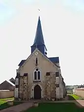
Kirche Saint-Germain
Weblinks
Commons: Buxières-d'Aillac – Sammlung von Bildern, Videos und Audiodateien
This article is issued from Wikipedia. The text is licensed under Creative Commons - Attribution - Sharealike. The authors of the article are listed here. Additional terms may apply for the media files, click on images to show image meta data.