Belleville-sur-Loire
Belleville-sur-Loire ist eine französische Gemeinde mit 1.010 Einwohnern (Stand: 1. Januar 2019) im Département Cher in der Region Centre-Val de Loire. Sie gehört zum Arrondissement Bourges und zum Kanton Sancerre (bis 2015: Kanton Léré). Die Einwohner werden Bellevillois genannt.
| Belleville-sur-Loire | ||
|---|---|---|
.svg.png.webp)
|
| |
| Staat | Frankreich | |
| Region | Centre-Val de Loire | |
| Département (Nr.) | Cher (18) | |
| Arrondissement | Bourges | |
| Kanton | Sancerre | |
| Gemeindeverband | Pays Fort Sancerrois Val de Loire | |
| Koordinaten | 47° 30′ N, 2° 51′ O | |
| Höhe | 133–231 m | |
| Fläche | 11,03 km² | |
| Einwohner | 1.010 (1. Januar 2019) | |
| Bevölkerungsdichte | 92 Einw./km² | |
| Postleitzahl | 18240 | |
| INSEE-Code | 18026 | |
| Website | http://www.bellevillesurloire.com/ | |
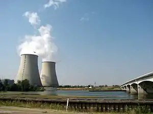 AKW Belleville | ||

Geographie
Belleville-sur-Loire liegt in Zentralfrankreich, etwa 53 Kilometer nordöstlich von Bourges. Umgeben wird Belleville-sur-Loire von den Nachbargemeinden Beaulieu-sur-Loire im Norden, Neuvy-sur-Loire im Osten und Nordosten, Sury-près-Léré im Süden sowie Santranges im Westen.
Im Gemeindegebiet liegt das Kernkraftwerk Belleville.
Bevölkerungsentwicklung
| Jahr | 1962 | 1968 | 1975 | 1982 | 1990 | 1999 | 2006 | 2013 |
| Einwohner | 321 | 352 | 288 | 448 | 1009 | 1088 | 1042 | 1037 |
| Quelle: Cassini und INSEE | ||||||||
Sehenswürdigkeiten
- Kirche aus dem 12. Jahrhundert
- Schlösser aus dem 15. und 17. Jahrhundert
- Reste einer römischen Siedlung
Literatur
- Le Patrimoine des Communes du Cher. Flohic Editions, Band 1, Paris 2001, ISBN 2-84234-088-4, S. 527–530.
Weblinks
Commons: Belleville-sur-Loire – Sammlung von Bildern, Videos und Audiodateien
This article is issued from Wikipedia. The text is licensed under Creative Commons - Attribution - Sharealike. The authors of the article are listed here. Additional terms may apply for the media files, click on images to show image meta data.