Yaté
Yaté ist eine Gemeinde in der Südprovinz in Neukaledonien.
| Yaté | |
|---|---|
 | |
| Staat | Frankreich |
| Provinz | Südprovinz |
| Aire coutumière | Djubéa-Kaponé |
| Koordinaten | 22° 10′ S, 166° 56′ O |
| Höhe | 0–1501 m |
| Fläche | 1316,79 km² |
| Einwohner | 1.667 (1. Januar 2019) |
| Bevölkerungsdichte | 1 Einw./km² |
| Postleitzahl | 98834 |
| INSEE-Code | 98832 |
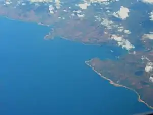
 Küstenverlauf bei Yaté | |
Die Gemeinde liegt auf der Hauptinsel Grande Terre. Hier liegt der Lac de Yaté, ein zur Stromerzeugung künstlich angelegter Stausee mit einer Größe von etwa 4000 ha. Die Orte der Gemeinde sind: Goro (Yaté)(?), Touaourou(?), Unia (Yaté)(?), Waho und Yaté (Hauptort).
Die höchste Erhebung ist im Massif de Kouakoué mit 1501 m.
Bevölkerung
| Bevölkerungsentwicklung in Yaté[1] | |||||||||||
|---|---|---|---|---|---|---|---|---|---|---|---|
| Einwohner | 1474 | 925 | 1113 | 1365 | 1387 | 1408 | 1554 | 1843 | 1881 | 1747 | 1667 |
| Jahr | 1956 | 1963 | 1969 | 1976 | 1983 | 1989 | 1996 | 2004 | 2009 | 2014 | 2019 |
Weblinks
Commons: Yaté – Sammlung von Bildern, Videos und Audiodateien
Einzelnachweise
- [https://de.wikipedia.org/w/index.php?title=Wikipedia:Defekte_Weblinks&dwl=http://www.world-gazetteer.com/wg.php?x=1230927631&men=gpro&lng=en&des=gamelan&geo=-155&srt=pnan&col=abcdefghimoq&msz=1500&pt=c&va=&geo=244294690: Seite nicht mehr abrufbar], Suche in Webarchiven: [http://timetravel.mementoweb.org/list/2010/http://www.world-gazetteer.com/wg.php?x=1230927631&men=gpro&lng=en&des=gamelan&geo=-155&srt=pnan&col=abcdefghimoq&msz=1500&pt=c&va=&geo=244294690: Bevölkerungsentwicklung von Yaté 1956–2009]
This article is issued from Wikipedia. The text is licensed under Creative Commons - Attribution - Sharealike. The authors of the article are listed here. Additional terms may apply for the media files, click on images to show image meta data.