Newfoundland and Labrador Census Division No. 8
Die Census Division No. 8 ist eine Verwaltungseinheit der kanadischen Provinz Neufundland und Labrador.
| Division No. 8 | |
|---|---|
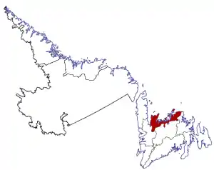 Lage der Region in Neufundland und Labrador | |
| Basisdaten | |
| Staat | Kanada |
| Provinz | Neufundland und Labrador |
| Koordinaten: | 48° 25′ N, 53° 53′ W |
| Einwohner | 35.794 (Stand: 2016) |
| Fläche | 9.314,57 km² |
| Bevölkerungsdichte | 3,8 Einw./km² |
| Zeitzone: | Newfoundland Standard Time (UTC−3:30) |
Die Census Division No. 8 erstreckt sich entlang der Nordküste der Insel Neufundland. Sie hat eine Fläche von 9314,57 km². Beim Zensus 2016 betrug die Einwohnerzahl 35.794.[1] Beim Zensus 2011 lag sie bei 37.121.[1]
Gemeinden (Towns)
- Baie Verte
- Baytona
- Beachside
- Birchy Bay
- Brent’s Cove
- Brighton
- Burlington
- Campbellton
- Carmanville
- Change Islands
- Coachman’s Cove
- Comfort Cove-Newstead
- Cottlesville
- Crow Head
- Embree
- Fleur de Lys
- Fogo
- Joe Batt’s Arm-Barr’d Islands-Shoal Bay
- King’s Point
- LaScie
- Leading Tickles
- Lewisporte
- Little Bay
- Little Burnt Bay
- Lumsden
- Lushes Bight-Beaumont-Beaumont North
- Middle Arm
- Miles Cove
- Ming’s Bight
- Musgrave Harbour
- Nippers Harbour
- Pacquet
- Pilley’s Island
- Point Leamington
- Point of Bay
- Port Anson
- Robert’s Arm
- Seal Cove (White Bay)
- Seldom-Little Seldom
- South Brook
- Springdale
- Summerford
- Tilt Cove
- Tilting
- Triton
- Twillingate
- Westport
- Woodstock
Einzelnachweise
- Division No. 8, Census 2016. Statistics Canada. Abgerufen am 3. Oktober 2018.
This article is issued from Wikipedia. The text is licensed under Creative Commons - Attribution - Sharealike. The authors of the article are listed here. Additional terms may apply for the media files, click on images to show image meta data.