Newfoundland and Labrador Census Division No. 10
Die Census Division No. 10 ist eine Verwaltungseinheit in der kanadischen Provinz Neufundland und Labrador.
| Division No. 10 | |
|---|---|
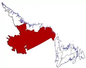 Lage der Region in Neufundland und Labrador | |
| Basisdaten | |
| Staat | Kanada |
| Provinz | Neufundland und Labrador |
| Koordinaten: | 53° 17′ N, 59° 38′ W |
| Einwohner | 24.639 (Stand: 2016) |
| Fläche | 199.703,36 km² |
| Bevölkerungsdichte | 0,1 Einw./km² |
| Zeitzone: | Newfoundland Standard Time (UTC−3:30) |
Die Census Division No. 10 erstreckt sich über den Süden von Labrador. Die Verwaltungseinheit hat eine Fläche von 199.703,36 km². Beim Zensus 2016 wurde eine Einwohnerzahl von 24.639 ermittelt.[1] Beim Zensus 2011 betrug sie 24.111.[1]
Gemeinden (Towns)
Census Subdivisions
- Subdivision A (L’Anse-Amour, Capstan Island)
- Subdivision B (Battle Harbour, Black Tickle-Domino, Lodge Bay, Normans Bay, Paradise River, Pinsent, William’s Harbour)
- Subdivision C (Sheshatshiu, Mud Lake)
- Subdivision D (Churchill Falls)
- Subdivision E (Natuashish)
Einzelnachweise
- Division No. 10, Census 2016. Statistics Canada. Abgerufen am 3. Oktober 2018.
This article is issued from Wikipedia. The text is licensed under Creative Commons - Attribution - Sharealike. The authors of the article are listed here. Additional terms may apply for the media files, click on images to show image meta data.