Newfoundland and Labrador Census Division No. 6
Die Census Division No. 6 ist eine Verwaltungseinheit in der kanadischen Provinz Neufundland und Labrador.
| Division No. 6 | |
|---|---|
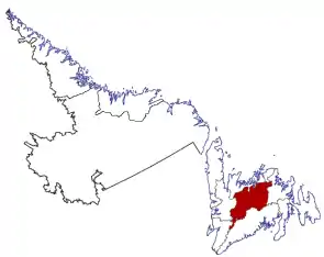 Lage der Region in Neufundland und Labrador | |
| Basisdaten | |
| Staat | Kanada |
| Provinz | Neufundland und Labrador |
| Koordinaten: | 49° 0′ N, 56° 0′ W |
| Einwohner | 38.345 (Stand: 2016) |
| Fläche | 16.238,16 km² |
| Bevölkerungsdichte | 2,4 Einw./km² |
| Zeitzone: | Newfoundland Standard Time (UTC−3:30) |
Die Census Division No. 6 erstreckt sich über den zentralen Norden der Insel Neufundland. Sie hat eine Fläche von 16.238,16 km². Beim Zensus 2016 lebten dort 38.345 Einwohner.[1] 5 Jahre zuvor lag die Einwohnerzahl bei 37.304.[1]
Gemeinden (Towns)
- Appleton
- Badger
- Bishop’s Falls
- Botwood
- Buchans
- Gander
- Glenwood
- Grand Falls-Windsor
- Millertown
- Norris Arm
- Northern Arm
- Peterview
Einzelnachweise
- Division No. 6, Census 2016. Statistics Canada. Abgerufen am 3. Oktober 2018.
This article is issued from Wikipedia. The text is licensed under Creative Commons - Attribution - Sharealike. The authors of the article are listed here. Additional terms may apply for the media files, click on images to show image meta data.