Newfoundland and Labrador Census Division No. 3
Die Census Division No. 3 ist eine Verwaltungseinheit in der kanadischen Provinz Neufundland und Labrador.
| Division No. 3 | |
|---|---|
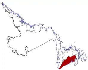 Lage der Region in Neufundland und Labrador | |
| Basisdaten | |
| Staat | Kanada |
| Provinz | Neufundland und Labrador |
| Koordinaten: | 47° 31′ N, 55° 25′ W |
| Einwohner | 16.306 (Stand: 2016) |
| Fläche | 19.912,67 km² |
| Bevölkerungsdichte | 0,8 Einw./km² |
| Zeitzone: | Newfoundland Standard Time (UTC−3:30) |
Die Census Division No. 3 befindet sich im Süden der Insel Neufundland. Sie hat eine Fläche von 19.912,67 km².[1] Beim Zensus 2016 betrug die Einwohnerzahl 15.560.[1] 5 Jahre zuvor lag sie noch bei 16.306.[1]
Gemeinden (Towns)
- Belleoram
- Burgeo
- Burnt Islands
- Channel-Port aux Basques
- Gaultois
- Harbour Breton
- Hermitage-Sandyville
- Isle aux Morts
- Milltown-Head of Bay d’Espoir
- Morrisville
- Pool’s Cove
- Ramea
- Rencontre East
- Rose Blanche-Harbour le Cou
- Seal Cove
- St. Alban’s
- St. Jacques-Coomb’s Cove
Einzelnachweise
- Division No. 3, Census 2016. Statistics Canada. Abgerufen am 3. Oktober 2018.
This article is issued from Wikipedia. The text is licensed under Creative Commons - Attribution - Sharealike. The authors of the article are listed here. Additional terms may apply for the media files, click on images to show image meta data.