Newfoundland and Labrador Census Division No. 1
Die Census Division No. 1 ist eine Verwaltungseinheit in der kanadischen Provinz Neufundland und Labrador.
| Division No. 1 | |
|---|---|
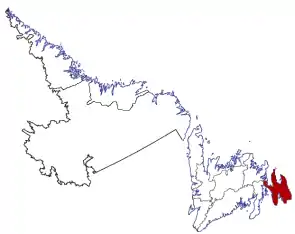 Lage der Region in Neufundland und Labrador | |
| Basisdaten | |
| Staat | Kanada |
| Provinz | Neufundland und Labrador |
| Koordinaten: | 47° 33′ N, 52° 42′ W |
| Einwohner | 270.348 (Stand: 2016) |
| Fläche | 9.220,61 km² |
| Bevölkerungsdichte | 29,3 Einw./km² |
| Zeitzone: | Newfoundland Standard Time (UTC−3:30) |
Die Census Division No. 1 erstreckt sich über die Avalon-Halbinsel im äußersten Osten der Insel Neufundland. Sie hat eine Fläche von 9.220,61 km².[1] Beim Zensus 2016 lebten dort 270.348 Einwohner.[1] 5 Jahre zuvor lag die Einwohnerzahl bei 262.410.[1] In der Division liegt St. John’s, die größte Stadt Neufundlands.
Städte (Citys)
Gemeinden (Towns)
- Admirals Beach
- Aquaforte
- Arnold’s Cove
- Avondale
- Bauline
- Bay Bulls
- Bay Roberts
- Bay de Verde
- Bishop’s Cove
- Branch
- Brigus
- Bryant’s Cove
- Cape Broyle
- Carbonear
- Chance Cove
- Chapel Arm
- Clarke’s Beach
- Colinet
- Colliers
- Come By Chance
- Conception Bay South
- Conception Harbour
- Cupids
- Fermeuse
- Ferryland
- Flatrock
- Fox Harbour
- Gaskiers-Point La Haye
- Hant’s Harbour
- Harbour Grace
- Harbour Main-Chapel’s Cove-Lakeview
- Heart’s Content
- Heart’s Delight-Islington
- Heart’s Desire
- Holyrood
- Logy Bay-Middle Cove-Outer Cove
- Long Harbour-Mount Arlington Heights
- Mount Carmel-Mitchells Brook-St. Catherine’s
- New Perlican
- Norman’s Cove-Long Cove
- North River
- Old Perlican
- Paradise
- Petty Harbour–Maddox Cove
- Placentia
- Point Lance
- Port Kirwan
- Portugal Cove South
- Portugal Cove-St. Philip’s
- Pouch Cove
- Renews-Cappahayden
- Riverhead
- Salmon Cove
- Small Point-Adam's Cove-Blackhead-Broad Cove
- South River
- Southern Harbour
- Spaniard’s Bay
- St. Bride's
- St. Joseph’s
- St. Mary’s
- St. Shott’s
- St. Vincent’s-St. Stephen’s-Peter’s River
- Sunnyside
- Torbay
- Trepassey
- Upper Island Cove
- Victoria
- Wabana
- Whitbourne
- Whiteway
- Winterton
- Witless Bay
Einzelnachweise
- Division No. 1, Census 2016. Statistics Canada. Abgerufen am 3. Oktober 2018.
This article is issued from Wikipedia. The text is licensed under Creative Commons - Attribution - Sharealike. The authors of the article are listed here. Additional terms may apply for the media files, click on images to show image meta data.