Newfoundland and Labrador Census Division No. 4
Die Census Division No. 4 ist eine Verwaltungseinheit in der kanadischen Provinz Neufundland und Labrador.
| Division No. 4 | |
|---|---|
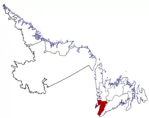 Lage der Region in Neufundland und Labrador | |
| Basisdaten | |
| Staat | Kanada |
| Provinz | Neufundland und Labrador |
| Koordinaten: | 48° 33′ N, 58° 34′ W |
| Einwohner | 20.387 (Stand: 2016) |
| Fläche | 7.087,65 km² |
| Bevölkerungsdichte | 2,9 Einw./km² |
| Zeitzone: | Newfoundland Standard Time (UTC−3:30) |
Die Census Division No. 4 befindet sich im äußersten Südwesten der Insel Neufundland. Sie hat eine Fläche von 7.087,65 km².[1] Beim Zensus 2016 lebten dort 20.387 Einwohner.[1] 5 Jahre zuvor betrug die Einwohnerzahl noch 20.840.[1]
Gemeinden (Towns)
- Cape St. George
- Gallants
- Kippens
- Lourdes
- Port au Port East
- Port au Port West-Aguathuna-Felix Cove
- St. George’s
- Stephenville
- Stephenville Crossing
Einzelnachweise
- Division No. 4, Census 2016. Statistics Canada. Abgerufen am 3. Oktober 2018.
This article is issued from Wikipedia. The text is licensed under Creative Commons - Attribution - Sharealike. The authors of the article are listed here. Additional terms may apply for the media files, click on images to show image meta data.