Kanton Châtel-sur-Moselle
Der Kanton Châtel-sur-Moselle war bis 2015 ein französischer Wahlkreis im Arrondissement Épinal, im Département Vosges und in der Region Lothringen; sein Hauptort war Châtel-sur-Moselle. Letzte Vertreterin im Generalrat des Départements war von 2008 bis 2015 Colette Marchal (zunächst DVD, jetzt NC).
| Ehemaliger Kanton Châtel-sur-Moselle | |
|---|---|
| Region | Lothringen |
| Département | Vosges |
| Arrondissement | Épinal |
| Hauptort | Châtel-sur-Moselle |
| Auflösungsdatum | 29. März 2015 |
| Einwohner | 19.871 (1. Jan. 2012) |
| Bevölkerungsdichte | 80 Einw./km² |
| Fläche | 247.94 km² |
| Gemeinden | 23 |
| INSEE-Code | 8806 |
Lage
Der Kanton lag im Norden des Départements Vosges.
 Lage des Kantons Châtel-sur-Moselle innerhalb des Arrondissements Épinal
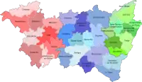 Lage des Kantons Châtel-sur-Moselle innerhalb des Départements Vosges
Gemeinden
Der Kanton bestand aus 23 Gemeinden:
| Gemeinde | Einwohner Jahr | Fläche km² | Bevölkerungsdichte | Code INSEE | Postleitzahl |
|---|---|---|---|---|---|
| Badménil-aux-Bois | 146 (2013) | 9,14 | 16 Einw./km² | 88027 | 88330 |
| Bayecourt | 271 (2013) | 6,92 | 39 Einw./km² | 88040 | 88150 |
| Châtel-sur-Moselle | 1.680 (2013) | 11,86 | 142 Einw./km² | 88094 | 88330 |
| Chavelot | 1.472 (2013) | 6,16 | 239 Einw./km² | 88099 | 88150 |
| Damas-aux-Bois | 266 (2013) | 29,46 | 9 Einw./km² | 88121 | 88330 |
| Domèvre-sur-Durbion | 290 (2013) | 12,51 | 23 Einw./km² | 88143 | 88330 |
| Frizon | 496 (2013) | 11,75 | 42 Einw./km² | 88190 | 88440 |
| Gigney | 55 (2013) | 5,09 | 11 Einw./km² | 88200 | 88390 |
| Girmont | 993 (2013) | 12,73 | 78 Einw./km² | 88204 | 88150 |
| Hadigny-les-Verrières | 382 (2013) | 13,74 | 28 Einw./km² | 88224 | 88330 |
| Haillainville | 173 (2013) | 12,26 | 14 Einw./km² | 88228 | 88330 |
| Igney | 1.181 (2013) | 7,66 | 154 Einw./km² | 88247 | 88150 |
| Mazeley | 271 (2013) | 10,39 | 26 Einw./km² | 88294 | 88150 |
| Moriville | 429 (2013) | 25,05 | 17 Einw./km² | 88313 | 88330 |
| Nomexy | 2.192 (2013) | 7,95 | 276 Einw./km² | 88327 | 88440 |
| Oncourt | 185 (2013) | 3,94 | 47 Einw./km² | 88337 | 88150 |
| Pallegney | 176 (2013) | 5,93 | 30 Einw./km² | 88342 | 88330 |
| Rehaincourt | 331 (2013) | 15,22 | 22 Einw./km² | 88379 | 88330 |
| Sercœur | 256 (2013) | 9,18 | 28 Einw./km² | 88454 | 88600 |
| Thaon-les-Vosges | 7.895 (2013) | 11,7 | 675 Einw./km² | 88465 | 88150 |
| Vaxoncourt | 527 (2013) | 8,43 | 63 Einw./km² | 88497 | 88330 |
| Villoncourt | 114 (2013) | 6,4 | 18 Einw./km² | 88509 | 88150 |
| Zincourt | 90 (2013) | 4,47 | 20 Einw./km² | 88532 | 88330 |
Bevölkerungsentwicklung
| 1962 | 1968 | 1975 | 1982 | 1990 | 1999 | 2006 | 2012 |
|---|---|---|---|---|---|---|---|
| 20.000 | 18.925 | 18.920 | 19.440 | 19.351 | 19.212 | 19.568 | 19.871 |
This article is issued from Wikipedia. The text is licensed under Creative Commons - Attribution - Sharealike. The authors of the article are listed here. Additional terms may apply for the media files, click on images to show image meta data.