Kanton Bourgogne
Der Kanton Bourgogne ist ein französischer Wahlkreis im Arrondissement Reims im Département Marne in der Region Grand Est; sein Hauptort ist Bourgogne-Fresne. Vertreter im Generalrat des Départements ist seit 2001 Eric Kariger (DVD).
| Kanton Bourgogne | |
|---|---|
| Region | Grand Est |
| Département | Marne |
| Arrondissement | Reims |
| Hauptort | Bourgogne-Fresne |
| Einwohner | 28.655 (1. Jan. 2019) |
| Bevölkerungsdichte | 77 Einw./km² |
| Fläche | 372,87 km² |
| Gemeinden | 27 |
| INSEE-Code | 5102 |
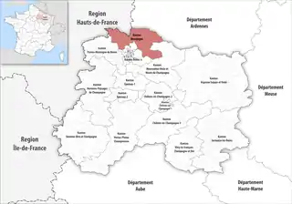 Lage des Kantons Bourgogne im Département Marne | |
Der Kanton besteht aus 27 Gemeinden mit insgesamt 28.655 Einwohnern (Stand: 1. Januar 2019) auf einer Gesamtfläche von 372,87 km²:
Gemeinden
| Gemeinde | Einwohner 1. Januar 2019 |
Fläche km² |
Dichte Einw./km² |
Code INSEE |
Postleitzahl |
|---|---|---|---|---|---|
| Auménancourt | 1.074 | 12,92 | 83 | 51025 | 51110 |
| Bazancourt | 2.352 | 11,72 | 201 | 51043 | 51110 |
| Beine-Nauroy | 995 | 42,79 | 23 | 51046 | 51490 |
| Berméricourt | 221 | 8,10 | 27 | 51051 | 51220 |
| Berru | 596 | 13,66 | 44 | 51052 | 51420 |
| Boult-sur-Suippe | 1.773 | 19,72 | 90 | 51074 | 51110 |
| Bourgogne-Fresne | 1.422 | 26,96 | 53 | 51075 | 51110 |
| Brimont | 448 | 12,68 | 35 | 51088 | 51220 |
| Caurel | 689 | 9,67 | 71 | 51101 | 51110 |
| Cauroy-lès-Hermonville | 469 | 10,21 | 46 | 51102 | 51220 |
| Cormicy | 1.487 | 31,90 | 47 | 51171 | 51220 |
| Courcy | 1.210 | 15,33 | 79 | 51183 | 51220 |
| Hermonville | 1.391 | 13,31 | 105 | 51291 | 51220 |
| Heutrégiville | 478 | 11,70 | 41 | 51293 | 51110 |
| Isles-sur-Suippe | 928 | 12,47 | 74 | 51299 | 51110 |
| Lavannes | 571 | 17,81 | 32 | 51318 | 51110 |
| Loivre | 1.348 | 10,24 | 132 | 51329 | 51220 |
| Merfy | 603 | 6,67 | 90 | 51362 | 51220 |
| Nogent-l’Abbesse | 524 | 10,25 | 51 | 51403 | 51420 |
| Pomacle | 465 | 11,15 | 42 | 51439 | 51110 |
| Pouillon | 506 | 2,83 | 179 | 51444 | 51220 |
| Saint-Étienne-sur-Suippe | 330 | 7,81 | 42 | 51477 | 51110 |
| Saint-Thierry | 616 | 7,56 | 81 | 51518 | 51220 |
| Thil | 301 | 2,12 | 142 | 51568 | 51220 |
| Villers-Franqueux | 296 | 3,24 | 91 | 51633 | 51220 |
| Warmeriville | 2.591 | 23,42 | 111 | 51660 | 51110 |
| Witry-lès-Reims | 4.971 | 16,63 | 299 | 51662 | 51420 |
| Kanton Bourgogne | 28.655 | 372,87 | 77 | 5102 | – |
Bis zur landesweiten Neuordnung der französischen Kantone im März 2015 gehörten zum Kanton Bourgogne die 24 Gemeinden Auménancourt, Bazancourt, Berméricourt, Boult-sur-Suippe, Bourgogne, Brimont, Caurel, Cauroy-lès-Hermonville, Cormicy, Courcy, Fresne-lès-Reims, Heutrégiville, Isles-sur-Suippe, Lavannes, Loivre, Merfy, Pomacle, Pouillon, Saint-Étienne-sur-Suippe, Saint-Thierry, Thil, Villers-Franqueux, Warmeriville und Witry-lès-Reims. Sein Zuschnitt entsprach einer Fläche von 2284,65 km2. Er besaß vor 2015 den INSEE-Code 5105.
Veränderungen im Gemeindebestand seit 2015
2017:
- Fusion Bourgogne und Fresne-lès-Reims → Bourgogne-Fresne
- Fusion Cormicy und Gernicourt (Departement Aisne) → Cormicy
Bevölkerungsentwicklung
| 1962 | 1968 | 1975 | 1982 | 1990 | 1999 | 2006 | 2011 |
|---|---|---|---|---|---|---|---|
| 12 815 | 13 584 | 13 849 | 18 254 | 20 450 | 21 212 | - | 23 334 |