Cumberland County (Pennsylvania)
Cumberland County[1] ist ein County im US-Bundesstaat Pennsylvania der Vereinigten Staaten. Bei der Volkszählung im Jahr 2020 hatte das County 259.469 Einwohner und eine Bevölkerungsdichte von 182 Einwohner pro Quadratkilometer.[2] Der Verwaltungssitz (County Seat) ist Carlisle.
.jpg.webp) Old Cumberland County Courthouse | |
| Verwaltung | |
|---|---|
| US-Bundesstaat: | Pennsylvania |
| Verwaltungssitz: | Carlisle |
| Adresse des Verwaltungssitzes: |
1 Courthouse Square Carlisle, PA 17013 |
| Gründung: | 1750 |
| Gebildet aus: | Lancaster County |
| Vorwahl: | 001 717 |
| Demographie | |
| Einwohner: | 259.469 (2020) |
| Bevölkerungsdichte: | 182,21 Einwohner/km2 |
| Geographie | |
| Fläche gesamt: | 1427 km² |
| Wasserfläche: | 3 km² |
| Karte | |
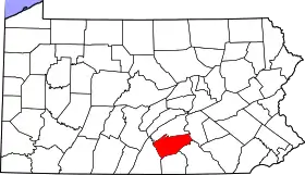 Karte von Cumberland County innerhalb von Pennsylvania | |
| Website: www.ccpa.net | |
Geschichte
Das County wurde am 27. Juni 1750 gegründet und nach der englischen Grafschaft Cumberland benannt.[3]

Zwei Orte im County haben den Status einer National Historic Landmark, die Carlisle Indian School und das Old West, Dickinson College.[4] 32 Bauwerke und Stätten des Countys sind im National Register of Historic Places (NRHP) eingetragen (Stand 22. Juli 2018).[5]
Geographie
Das County hat eine Fläche von 1427 Quadratkilometern, wovon 3 Quadratkilometer Wasserfläche sind.
| Bevölkerungsentwicklung | |||
|---|---|---|---|
| Census | Einwohner | ± in % | |
| 1790 | 18.208 | — | |
| 1800 | 25.386 | 39,4 % | |
| 1810 | 26.757 | 5,4 % | |
| 1820 | 23.606 | −11,8 % | |
| 1830 | 29.226 | 23,8 % | |
| 1840 | 30.953 | 5,9 % | |
| 1850 | 34.327 | 10,9 % | |
| 1860 | 40.098 | 16,8 % | |
| 1870 | 43.912 | 9,5 % | |
| 1880 | 45.977 | 4,7 % | |
| 1890 | 47.271 | 2,8 % | |
| 1900 | 50.344 | 6,5 % | |
| 1910 | 54.479 | 8,2 % | |
| 1920 | 58.578 | 7,5 % | |
| 1930 | 68.236 | 16,5 % | |
| 1940 | 74.806 | 9,6 % | |
| 1950 | 94.457 | 26,3 % | |
| 1960 | 124.816 | 32,1 % | |
| 1970 | 158.177 | 26,7 % | |
| 1980 | 178.541 | 12,9 % | |
| 1990 | 195.257 | 9,4 % | |
| 2000 | 213.670 | 9,4 % | |
| 2010 | 235.406 | 10,2 % | |
| 2020 | 259.469 | 10,2 % | |
| Vor 1900[6] | |||
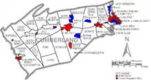
Städte und Ortschaften
|
|
|
Einzelnachweise
- Cumberland County im Geographic Names Information System des United States Geological Survey. Abgerufen am 22. Februar 2011
- U.S. Census Bureau QuickFacts: Cumberland County, Pennsylvania. Abgerufen am 28. August 2021 (englisch).
- Charles Curry Aiken, Joseph Nathan Kane: The American Counties: Origins of County Names, Dates of Creation, Area, and Population Data, 1950–2010. 6. Auflage. Scarecrow Press, Lanham 2013, ISBN 978-0-8108-8762-6, S. 75.
- Listing of National Historic Landmarks by State: Pennsylvania. National Park Service, abgerufen am 22. Juli 2018.
- Suchmaske Datenbank im National Register Information System. National Park Service, abgerufen am 22. Juli 2018.
- U.S. Census Bureau _ Census of Population and Housing. Abgerufen am 28. Februar 2011
- Auszug aus Census.gov. Abgerufen am 28. Februar 2011
- Auszug aus factfinder.census.gov Abgerufen am 28. Februar 2011
Weblinks
Liste der Countys in Pennsylvania
Adams |
Allegheny |
Armstrong |
Beaver |
Bedford |
Berks |
Blair |
Bradford |
Bucks |
Butler |
Cambria |
Cameron |
Carbon |
Centre |
Chester |
Clarion |
Clearfield |
Clinton |
Columbia |
Crawford |
Cumberland |
Dauphin |
Delaware |
Elk |
Erie |
Fayette |
Forest |
Franklin |
Fulton |
Greene |
Huntingdon |
Indiana |
Jefferson |
Juniata |
Lackawanna |
Lancaster |
Lawrence |
Lebanon |
Lehigh |
Luzerne |
Lycoming |
McKean |
Mercer |
Mifflin |
Monroe |
Montgomery |
Montour |
Northampton |
Northumberland |
Perry |
Philadelphia |
Pike |
Potter |
Schuylkill |
Snyder |
Somerset |
Sullivan |
Susquehanna |
Tioga |
Union |
Venango |
Warren |
Washington |
Wayne |
Westmoreland |
Wyoming |
York