Busloup
Busloup ist eine französische Gemeinde mit 468 Einwohnern (Stand: 1. Januar 2019) im Département Loir-et-Cher in der Region Centre-Val de Loire. Administrativ ist sie dem Kanton Le Perche (bis 2015: Kanton Morée) und dem Arrondissement Vendôme zugeteilt. Die Einwohner werden Bucilliens genannt.
| Busloup | ||
|---|---|---|
|
| |
| Staat | Frankreich | |
| Region | Centre-Val de Loire | |
| Département (Nr.) | Loir-et-Cher (41) | |
| Arrondissement | Vendôme | |
| Kanton | Le Perche | |
| Gemeindeverband | Le Perche et Haut Vendômois | |
| Koordinaten | 47° 54′ N, 1° 8′ O | |
| Höhe | 88–162 m | |
| Fläche | 18,97 km² | |
| Einwohner | 468 (1. Januar 2019) | |
| Bevölkerungsdichte | 25 Einw./km² | |
| Postleitzahl | 41160 | |
| INSEE-Code | 41028 | |
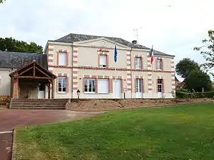 Rathaus (Mairie) von Busloup | ||

Geografie
Busloup liegt etwa 36 Kilometer nordnordwestlich von Blois in der Landschaft Le Perche. Umgeben wird Busloup von den Nachbargemeinden La Ville-aux-Clercs im Norden und Westen, Saint-Hilaire-la-Gravelle im Nordosten, Fréteval im Osten, Pezou im Süden und Südosten sowie Lisle im Südwesten.
Bevölkerungsentwicklung
| Jahr | 1962 | 1968 | 1975 | 1982 | 1990 | 1999 | 2006 | 2017 | |||
|---|---|---|---|---|---|---|---|---|---|---|---|
| Einwohner | 360 | 332 | 309 | 336 | 361 | 379 | 445 | 439 | |||
| Quellen: Cassini und INSEE | |||||||||||
Sehenswürdigkeiten
- Kirche Sainte-Anne-et-Saint-Pierre, Monument historique
- Kapelle Sainte-Radégonde
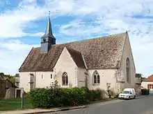
Kirche Sainte-Anne-et-Saint-Pierre
Weblinks
Commons: Busloup – Sammlung von Bildern, Videos und Audiodateien
This article is issued from Wikipedia. The text is licensed under Creative Commons - Attribution - Sharealike. The authors of the article are listed here. Additional terms may apply for the media files, click on images to show image meta data.