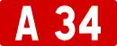
Autoroute A 34
Die Autoroute A 34 ist eine französische Autobahn mit Beginn in Reims und Ende in Sedan. Ihre Länge beträgt 62 km.
| Autoroute A34 in Frankreich | ||||||||||||||||||||||||||||||||||||||||||||||||||||||||||||||||||||||||||||||||||||||||||||||||||||||||||||||||||||||||||||
 | ||||||||||||||||||||||||||||||||||||||||||||||||||||||||||||||||||||||||||||||||||||||||||||||||||||||||||||||||||||||||||||
| | ||||||||||||||||||||||||||||||||||||||||||||||||||||||||||||||||||||||||||||||||||||||||||||||||||||||||||||||||||||||||||||
| Basisdaten | ||||||||||||||||||||||||||||||||||||||||||||||||||||||||||||||||||||||||||||||||||||||||||||||||||||||||||||||||||||||||||||
| Betreiber: | DIR Nord | |||||||||||||||||||||||||||||||||||||||||||||||||||||||||||||||||||||||||||||||||||||||||||||||||||||||||||||||||||||||||||
| Gesamtlänge: | 62 km | |||||||||||||||||||||||||||||||||||||||||||||||||||||||||||||||||||||||||||||||||||||||||||||||||||||||||||||||||||||||||||
 | ||||||||||||||||||||||||||||||||||||||||||||||||||||||||||||||||||||||||||||||||||||||||||||||||||||||||||||||||||||||||||||
| Die A 34 bei Reims | ||||||||||||||||||||||||||||||||||||||||||||||||||||||||||||||||||||||||||||||||||||||||||||||||||||||||||||||||||||||||||||
Straßenverlauf
| ||||||||||||||||||||||||||||||||||||||||||||||||||||||||||||||||||||||||||||||||||||||||||||||||||||||||||||||||||||||||||||
Geschichte
- 4. Dezember 1973: Eröffnung Villers-Semeuse - Sedan-ouest (Abfahrt 8 - 4)
- ?. ? 1990: Eröffnung Acy-Romance - Rethel-est (Abfahrt 18 - 15) → (N 51)
- ?. ? 1995: Eröffnung La Francheville - Yvernaumont (Abfahrt 9 - 12)
- ?. September 1999: Eröffnung Witry-lès-Reims - Saint-Léonard (Abfahrt 24 - D 944)
- 31. Mai 2000: Eröffnung Yvernaumont - Poix-Terron (Abfahrt 12 - 13)
- 20. Dezember 2002: Eröffnung Poix-Terron - Faissault (Abfahrt 13 - 14)
- 20. Dezember 2003: Eröffnung Faissault - Rethel-est (Abfahrt 14 - 15)
- ?. ? 2006: Eröffnung Saint-Léonard - Reims-Cormontreuil (D 944 - A 4)
- 1. Dezember 2009: Eröffnung Ardennes (Abfahrt 14)
Großstädte an der Autobahn
Weblinks
- Autoroute A 34 in deutscher und französischer Fassung des SARATLAS
- Autoroute A 34 auf WikiSara (frz.)
Portal Straßen • WikiProjekt Straßen
This article is issued from Wikipedia. The text is licensed under Creative Commons - Attribution - Sharealike. The authors of the article are listed here. Additional terms may apply for the media files, click on images to show image meta data.