Valderoure
Valderoure ist eine französische Gemeinde im Département Alpes-Maritimes in der Region Provence-Alpes-Côte d’Azur. Sie gehört zum Kanton Grasse-1 im Arrondissement Grasse.
| Valderoure | ||
|---|---|---|
.svg.png.webp)
|
| |
| Staat | Frankreich | |
| Region | Provence-Alpes-Côte d’Azur | |
| Département (Nr.) | Alpes-Maritimes (06) | |
| Arrondissement | Grasse | |
| Kanton | Grasse-1 | |
| Gemeindeverband | Pays de Grasse | |
| Koordinaten | 43° 48′ N, 6° 43′ O | |
| Höhe | 1027–1645 m | |
| Fläche | 25,19 km² | |
| Einwohner | 464 (1. Januar 2019) | |
| Bevölkerungsdichte | 18 Einw./km² | |
| Postleitzahl | 06750 | |
| INSEE-Code | 06154 | |
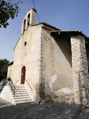 Kirche Notre-Dame-de-l’Assomption-et-Saint-Roch | ||

Geografie
Die Gemeinde liegt im Regionalen Naturpark Préalpes d’Azur. Der Artuby, der in Peyroules entspringt, fließt durch Valderoure auf der Westseite. Die angrenzenden Gemeinden sind Saint-Auban im Norden, Andon im Osten, Caille und Séranon im Süden, Châteauvieux (Berührungspunkt) im Westen und Peyroules im Nordwesten.
Bevölkerungsentwicklung
| 1962 | 1968 | 1975 | 1982 | 1990 | 1999 | 2007 | 2016 |
|---|---|---|---|---|---|---|---|
| 111 | 132 | 110 | 167 | 178 | 306 | 384 | 441 |
Sehenswürdigkeiten
Literatur
- Le Patrimoine des Communes des Alpes-Maritimes. Flohic Editions, Band 2, Paris 2000, ISBN 2-84234-071-X, S. 820–821.
Weblinks
Commons: Valderoure – Sammlung von Bildern, Videos und Audiodateien
This article is issued from Wikipedia. The text is licensed under Creative Commons - Attribution - Sharealike. The authors of the article are listed here. Additional terms may apply for the media files, click on images to show image meta data.