Saint-Cyr-le-Gravelais
Saint-Cyr-le-Gravelais ist eine französische Gemeinde mit 559 Einwohnern (Stand: 1. Januar 2019) im Département Mayenne in der Region Pays de la Loire. Sie gehört zum Arrondissement Laval und zum Kanton Loiron-Ruillé. Die Einwohner werden Saint-Cyriens genannt.
| Saint-Cyr-le-Gravelais | ||
|---|---|---|
| ||
| Staat | Frankreich | |
| Region | Pays de la Loire | |
| Département (Nr.) | Mayenne (53) | |
| Arrondissement | Laval | |
| Kanton | Loiron-Ruillé | |
| Gemeindeverband | Laval | |
| Koordinaten | 48° 2′ N, 1° 2′ W | |
| Höhe | 82–177 m | |
| Fläche | 20,47 km² | |
| Einwohner | 559 (1. Januar 2019) | |
| Bevölkerungsdichte | 27 Einw./km² | |
| Postleitzahl | 53320 | |
| INSEE-Code | 53209 | |
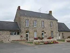 Rathaus (Mairie) von Saint-Cyr-le-Gravelais | ||

Geographie
Saint-Cyr-le-Gravelais liegt etwa 20 Kilometer westsüdwestlich von Laval. Umgeben wird Saint-Cyr-le-Gravelais von den Nachbargemeinden La Gravelle im Norden, Loiron-Ruillé im Osten und Nordosten, Montjean im Südosten, Beaulieu-sur-Oudon im Süden sowie Le Pertre im Westen.
Bevölkerungsentwicklung
| Jahr | 1962 | 1968 | 1975 | 1982 | 1990 | 1999 | 2006 | 2019 |
| Einwohner | 498 | 462 | 428 | 408 | 472 | 474 | 528 | 559 |
| Quellen: Cassini und INSEE | ||||||||
Sehenswürdigkeiten
- Kirche Saint-Cyr-Sainte-Julitte
_%C3%89glise_01.JPG.webp)
Kirche Saint-Cyr-Sainte-Julitte
Literatur
- Le Patrimoine des Communes de la Mayenne. Flohic Editions, Band 2, Paris 2002, ISBN 2-84234-135-X, S. 667–668.
This article is issued from Wikipedia. The text is licensed under Creative Commons - Attribution - Sharealike. The authors of the article are listed here. Additional terms may apply for the media files, click on images to show image meta data.