Roquefort-la-Bédoule
Roquefort-la-Bédoule ist eine französische Gemeinde mit 6.015 Einwohnern (Stand 1. Januar 2019) im Département Bouches-du-Rhône in der Region Provence-Alpes-Côte d’Azur; sie gehört zum Arrondissement Marseille und zum Kanton La Ciotat.
| Roquefort-la-Bédoule | ||
|---|---|---|
.svg.png.webp)
|
| |
| Staat | Frankreich | |
| Region | Provence-Alpes-Côte d’Azur | |
| Département (Nr.) | Bouches-du-Rhône (13) | |
| Arrondissement | Marseille | |
| Kanton | La Ciotat | |
| Gemeindeverband | Métropole d’Aix-Marseille-Provence | |
| Koordinaten | 43° 15′ N, 5° 35′ O | |
| Höhe | 158–567 m | |
| Fläche | 30,98 km² | |
| Einwohner | 6.015 (1. Januar 2019) | |
| Bevölkerungsdichte | 194 Einw./km² | |
| Postleitzahl | 13830 | |
| INSEE-Code | 13085 | |
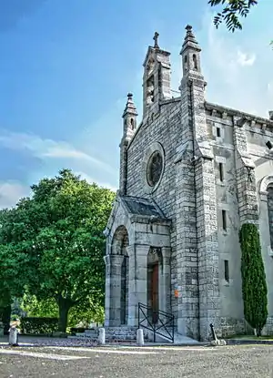
 Kirche Sainte-Roseline | ||
Lage
Roquefort-la-Bédoule liegt östlich von Marseille zwischen Aubagne und La Ciotat. Die Gemeinde liegt zwar außerhalb des Regionalen Naturparks Sainte-Baume, ist mit diesem jedoch assoziiert.
Bevölkerungsentwicklung
- 1962: 1635
- 1968: 1770
- 1975: 2384
- 1982: 3355
- 1990: 4162
- 1999: 4733
- 2008: 5038
- 2016: 5632
Sehenswürdigkeiten
- Burg von Roquefort (9.–12. Jahrhundert)
- Kapelle Saint-André (1143 als Notre-Dame de Julhans erwähnt)
- Kirche Sainte-Roseline (17. Jahrhundert)
- Château de Julhans (17. Jahrhundert)
Persönlichkeiten
- Tony Garnier (1869–1948), Architekt
This article is issued from Wikipedia. The text is licensed under Creative Commons - Attribution - Sharealike. The authors of the article are listed here. Additional terms may apply for the media files, click on images to show image meta data.
