Reuilly (Eure)
| Reuilly | ||
|---|---|---|
.svg.png.webp)
|
| |
| Staat | Frankreich | |
| Region | Normandie | |
| Département (Nr.) | Eure (27) | |
| Arrondissement | Évreux | |
| Kanton | Évreux-2 | |
| Gemeindeverband | Évreux Portes de Normandie | |
| Koordinaten | 49° 5′ N, 1° 13′ O | |
| Höhe | 49–144 m | |
| Fläche | 9,73 km² | |
| Einwohner | 521 (1. Januar 2019) | |
| Bevölkerungsdichte | 54 Einw./km² | |
| Postleitzahl | 27930 | |
| INSEE-Code | 27489 | |
| Website | http://www.mairiereuilly27.fr/ | |
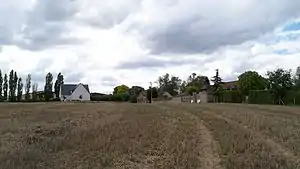 Rathaus von Reuilly | ||

Reuilly ist eine französische Gemeinde mit 521 Einwohnern (Stand: 1. Januar 2019) im Département Eure in der Region Normandie. Die Gemeinde gehört zum Arrondissement Évreux und zum Kanton Évreux-2 (bis 2015: Kanton Évreux-Sud). Die Einwohner werden Reuillois genannt.
Geografie
Reuilly liegt in Nordfrankreich im Osten des Départements Eure, etwa acht Kilometer nordöstlich vom Stadtzentrum von Évreux. Umgeben wird Reuilly von den Nachbargemeinden
- Clef Vallée d’Eure mit La Croix-Saint-Leufroy im Norden und Écardenville-sur-Eure im Nordosten,
- Saint-Vigor im Osten,
- Fontaine-sous-Jouy im Osten und Südosten,
- Sassey im Süden,
- Normanville und Le Boulay-Morin im Westen und Südwesten,
- Dardez im Westen,
- Irreville im Nordwesten.
Bevölkerungsentwicklung
| Jahr | 1962 | 1968 | 1975 | 1982 | 1990 | 1999 | 2006 | 2013 |
| Einwohner | 223 | 199 | 239 | 322 | 426 | 501 | 534 | 574 |
| Quelle: Cassini und INSEE | ||||||||
Sehenswürdigkeiten
- Kirche Saint-Christophe

Kirche Saint-Christophe
Weblinks
Commons: Reuilly – Sammlung von Bildern, Videos und Audiodateien
This article is issued from Wikipedia. The text is licensed under Creative Commons - Attribution - Sharealike. The authors of the article are listed here. Additional terms may apply for the media files, click on images to show image meta data.