Montrelais
Montrelais ist eine französische Gemeinde mit 840 Einwohnern (Stand 1. Januar 2019) im Département Loire-Atlantique in der Region Pays de la Loire; sie gehört zum Arrondissement Châteaubriant-Ancenis und zum Kanton Ancenis (bis 2015: Kanton Varades).
| Montrelais | ||
|---|---|---|
.svg.png.webp)
|
| |
| Staat | Frankreich | |
| Region | Pays de la Loire | |
| Département (Nr.) | Loire-Atlantique (44) | |
| Arrondissement | Châteaubriant-Ancenis | |
| Kanton | Ancenis | |
| Gemeindeverband | Pays d’Ancenis | |
| Koordinaten | 47° 23′ N, 0° 58′ W | |
| Höhe | 7–62 m | |
| Fläche | 14,02 km² | |
| Einwohner | 840 (1. Januar 2019) | |
| Bevölkerungsdichte | 60 Einw./km² | |
| Postleitzahl | 44370 | |
| INSEE-Code | 44104 | |
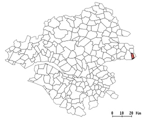
 Lage von Montrelais im Département | ||
Lage
Die Gemeinde liegt am rechten Ufer der Loire und wird vom Fluss Boire Torse durchquert, der hier noch Ruisseau de Bray genannt wird. Nachbargemeinden von Montrelais sind La Chapelle-Saint-Sauveur im Norden, Ingrandes-Le Fresne sur Loire im Osten und Varades im Westen.
Bevölkerungsentwicklung
| Jahr | 1962 | 1968 | 1975 | 1982 | 1990 | 1999 | 2008 | 2017 |
| Einwohner | 558 | 514 | 541 | 587 | 587 | 664 | 807 | 852 |
Sehenswürdigkeiten
_%C3%89glise_Saint-Pierre_-_Ext%C3%A9rieur_01.jpg.webp)
Kirche Saint-Pierre
- Kirche Saint-Pierre (15./18. Jahrhundert, Monument historique)
Persönlichkeiten
- Rodolphe Bresdin (1822–1885), Grafiker, geboren in Montrelais
Literatur
- Le Patrimoine des Communes de la Loire-Atlantique. Flohic Editions, Band 2, Charenton-le-Pont 1999, ISBN 2-84234-040-X, S. 1315–1321.
This article is issued from Wikipedia. The text is licensed under Creative Commons - Attribution - Sharealike. The authors of the article are listed here. Additional terms may apply for the media files, click on images to show image meta data.
