Kanton Romorantin-Lanthenay
Der Kanton Romorantin-Lanthenay ist ein französischer Wahlkreis im Arrondissement Romorantin-Lanthenay im Département Loir-et-Cher in der Region Centre-Val de Loire; sein Hauptort ist Romorantin-Lanthenay.
| Kanton Romorantin-Lanthenay | |
|---|---|
| Region | Centre-Val de Loire |
| Département | Loir-et-Cher |
| Arrondissement | Romorantin-Lanthenay |
| Hauptort | Romorantin-Lanthenay |
| Einwohner | 20.097 (1. Jan. 2019) |
| Bevölkerungsdichte | 72 Einw./km² |
| Fläche | 278,88 km² |
| Gemeinden | 6 |
| INSEE-Code | 4110 |
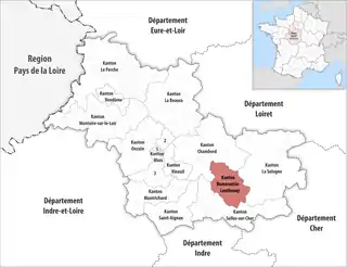 Lage des Kantons Romorantin-Lanthenay im Département Loir-et-Cher | |
Der Kanton wurde im Zuge der Neuordnung der französischen Kantone im Jahr 2015 neu geschaffen und umfasst neben der Stadt Romorantin-Lanthenay (zuvor Kanton Romorantin-Lanthenay-Nord und Kanton Romorantin-Lanthenay-Sud) fünf weitere Gemeinden.
Gemeinden
Der Kanton besteht aus sechs Gemeinden mit insgesamt 20.097 Einwohnern (Stand: 1. Januar 2019) auf einer Gesamtfläche von 278,88 km²:
| Gemeinde | Einwohner 1. Januar 2019 |
Fläche km² |
Dichte Einw./km² |
Code INSEE |
Postleitzahl |
|---|---|---|---|---|---|
| Loreux | 200 | 32,15 | 6 | 41118 | 41200 |
| Millançay | 739 | 61,69 | 12 | 41140 | 41200 |
| Romorantin-Lanthenay | 17.924 | 44,97 | 399 | 41194 | 41200 |
| Veilleins | 161 | 46,58 | 3 | 41268 | 41230 |
| Vernou-en-Sologne | 631 | 54,70 | 12 | 41271 | 41230 |
| Villeherviers | 442 | 38,79 | 11 | 41282 | 41200 |
| Kanton Romorantin-Lanthenay | 20.097 | 278,88 | 72 | 4110 | – |
This article is issued from Wikipedia. The text is licensed under Creative Commons - Attribution - Sharealike. The authors of the article are listed here. Additional terms may apply for the media files, click on images to show image meta data.