Kanton Canteleu
Der Kanton Canteleu ist ein französischer Wahlkreis im Arrondissement Rouen im Département Seine-Maritime in der Region Normandie; sein Hauptort ist Canteleu.
| Kanton Canteleu | |
|---|---|
| Region | Normandie |
| Département | Seine-Maritime |
| Arrondissement | Rouen |
| Hauptort | Canteleu |
| Einwohner | 27.728 (1. Jan. 2019) |
| Bevölkerungsdichte | 498 Einw./km² |
| Fläche | 55,66 km² |
| Gemeinden | 6 |
| INSEE-Code | 7604 |
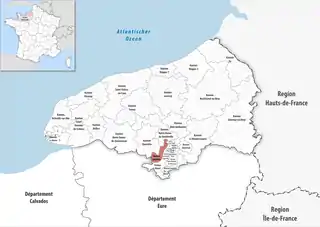 Lage des Kantons Canteleu im Département Seine-Maritime | |
Gemeinden
Der Kanton besteht aus sechs Gemeinden mit insgesamt 27.728 Einwohnern (Stand: 1. Januar 2019) auf einer Gesamtfläche von 55,66 km²:
| Gemeinde | Einwohner 1. Januar 2019 |
Fläche km² |
Dichte Einw./km² |
Code INSEE |
Postleitzahl |
|---|---|---|---|---|---|
| Canteleu | 13.846 | 17,65 | 784 | 76157 | 76380 |
| Hautot-sur-Seine | 399 | 2,19 | 182 | 76350 | 76113 |
| Maromme | 10.663 | 4,15 | 2.569 | 76410 | 76150 |
| Sahurs | 1.205 | 11,11 | 108 | 76550 | 76113 |
| Saint-Pierre-de-Manneville | 897 | 10,26 | 87 | 76634 | 76113 |
| Val-de-la-Haye | 718 | 10,30 | 70 | 76717 | 76380 |
| Kanton Canteleu | 27.728 | 55,66 | 498 | 7604 | – |
This article is issued from Wikipedia. The text is licensed under Creative Commons - Attribution - Sharealike. The authors of the article are listed here. Additional terms may apply for the media files, click on images to show image meta data.