Kanton Bourbon-l’Archambault
Der Kanton Bourbon-l’Archambault ist ein französischer Wahlkreis im Département Allier in der Region Auvergne-Rhône-Alpes. Er umfasst 28 Gemeinden in den Arrondissements Montluçon und Moulins, sein bureau centralisateur ist in Bourbon-l’Archambault.
| Kanton Bourbon-l’Archambault | |
|---|---|
| Region | Auvergne-Rhône-Alpes |
| Département | Allier |
| Arrondissement | Montluçon Moulins |
| Bureau centralisateur | Bourbon-l’Archambault |
| Gründungsdatum | 4. März 1790 |
| Einwohner | 16.689 (1. Jan. 2019) |
| Bevölkerungsdichte | 17 Einw./km² |
| Fläche | 963,17 km² |
| Gemeinden | 28 |
| INSEE-Code | 0302 |
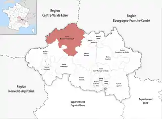 Lage des Kantons Bourbon-l’Archambault im Département Allier | |
Gemeinden
Der Kanton besteht aus 28 Gemeinden mit insgesamt 16.689 Einwohnern (Stand: 1. Januar 2019) auf einer Gesamtfläche von 963,17 km²:
| Gemeinde | Einwohner 1. Januar 2019 |
Fläche km² |
Dichte Einw./km² |
Code INSEE |
Postleitzahl | Arrondissement |
|---|---|---|---|---|---|---|
| Ainay-le-Château | 987 | 24,24 | 41 | 03003 | 03360 | Montluçon |
| Bourbon-l’Archambault | 2.572 | 55,28 | 47 | 03036 | 03160 | Moulins |
| Braize | 259 | 21,04 | 12 | 03037 | 03360 | Montluçon |
| Buxières-les-Mines | 1.026 | 47,62 | 22 | 03046 | 03440 | Moulins |
| Cérilly | 1.305 | 70,96 | 18 | 03048 | 03350 | Montluçon |
| Château-sur-Allier | 180 | 27,84 | 6 | 03064 | 03320 | Moulins |
| Couleuvre | 597 | 54,01 | 11 | 03087 | 03320 | Moulins |
| Couzon | 305 | 20,20 | 15 | 03090 | 03160 | Moulins |
| Franchesse | 475 | 40,59 | 12 | 03117 | 03160 | Moulins |
| Isle-et-Bardais | 279 | 45,03 | 6 | 03130 | 03360 | Montluçon |
| Lételon | 92 | 6,31 | 15 | 03143 | 03360 | Montluçon |
| Le Veurdre | 454 | 21,48 | 21 | 03309 | 03320 | Moulins |
| Le Vilhain | 275 | 26,48 | 10 | 03313 | 03350 | Montluçon |
| Limoise | 154 | 12,67 | 12 | 03146 | 03320 | Moulins |
| Lurcy-Lévis | 1.881 | 72,07 | 26 | 03155 | 03320 | Moulins |
| Meaulne-Vitray | 906 | 49,83 | 18 | 03168 | 03360 | Montluçon |
| Neure | 187 | 12,11 | 15 | 03198 | 03320 | Moulins |
| Pouzy-Mésangy | 399 | 35,36 | 11 | 03210 | 03320 | Moulins |
| Saint-Aubin-le-Monial | 272 | 21,97 | 12 | 03218 | 03160 | Moulins |
| Saint-Bonnet-Tronçais | 730 | 28,22 | 26 | 03221 | 03360 | Montluçon |
| Saint-Hilaire | 529 | 20,94 | 25 | 03238 | 03440 | Moulins |
| Saint-Léopardin-d’Augy | 368 | 39,84 | 9 | 03241 | 03160 | Moulins |
| Saint-Plaisir | 376 | 52,61 | 7 | 03251 | 03160 | Moulins |
| Theneuille | 372 | 39,69 | 9 | 03282 | 03350 | Montluçon |
| Urçay | 283 | 12,53 | 23 | 03293 | 03360 | Montluçon |
| Valigny | 376 | 20,97 | 18 | 03296 | 03360 | Montluçon |
| Vieure | 274 | 30,01 | 9 | 03312 | 03430 | Moulins |
| Ygrande | 776 | 53,27 | 15 | 03320 | 03160 | Moulins |
| Kanton Bourbon-l’Archambault | 16.689 | 963,17 | 17 | 0302 | – | – |
Veränderungen im Gemeindebestand seit 2015
2017: Fusion Meaulne und Vitray → Meaulne-Vitray
Geschichte
Der Kanton Bourbon-l’Archambault entstand am 4. März 1790 im Zuge der Einrichtung der Départements als Teil des damaligen District de Cérilly.[1] Mit der Gründung der Arrondissements am 17. Februar 1800 wurde der Kanton im Zuschnitt noch einmal verändert und dem neuen Arrondissement Moulins zugeordnet. Die landesweite Neuordnung der französischen Kantone brachte 2015 eine erhebliche Erweiterung von acht auf 29 Gemeinden. Die acht Gemeinden vor der Neuordnung waren Bourbon-l’Archambault, Buxières-les-Mines, Franchesse, Saint-Aubin-le-Monial, Saint-Hilaire, Saint-Plaisir, Vieure und Ygrande. Der alte Kanton umfasste eine Fläche von 319,36 km2 und besaß vor 2015 den INSEE-Code 0301.
Einwohnerentwicklung
| Jahr | Einwohner |
|---|---|
| 1962 | 7625 |
| 1968 | 8401 |
| 1975 | 7317 |
| 1982 | 7092 |
| 1990 | 6769 |
| 1999 | 6532 |
| 2006 | 6419 |
| 2011 | 6295 |
Politik
| Amtszeit | Namen | Partei |
|---|---|---|
| 2003–2015 | Gilles Mazuel | PCF |
| 2015– | Gérard Deriot Corinne Trebosc-Coupas | – |
Einzelnachweise
- Louis Marie Prudhomme: Dictionnaire géographique et méthodique de la République française en 120 départements. Erster Band. Chez Prudhomme, Paris, 1798, S. 148 (Online in der Google-Buchsuche).