Kanton Chartres-2
Der Kanton Chartres-2 ist eine französische Verwaltungseinheit im Arrondissement Chartres im Département Eure-et-Loir in der Region Centre-Val de Loire; sein Hauptort ist Chartres.
| Kanton Chartres-2 | |
|---|---|
| Region | Centre-Val de Loire |
| Département | Eure-et-Loir |
| Arrondissement | Chartres |
| Hauptort | Chartres |
| Einwohner | 27.831 (1. Jan. 2019) |
| Bevölkerungsdichte | 125 Einw./km² |
| Fläche | 222,85 km² |
| Gemeinden | 14 1⁄3 |
| INSEE-Code | 2805 |
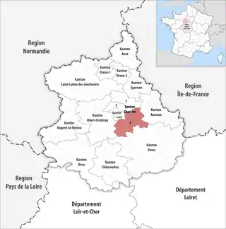 Lage des Kantons Chartres-2 im Département Eure-et-Loir | |
Gemeinden
Der Kanton besteht aus 15 Gemeinden und Teilgemeinden mit insgesamt 27.831 Einwohnern (Stand: 1. Januar 2019) auf einer Gesamtfläche von 222,85 km²:
| Gemeinde | Einwohner 1. Januar 2019 |
Fläche km² |
Dichte Einw./km² |
Code INSEE |
Postleitzahl |
|---|---|---|---|---|---|
| Berchères-les-Pierres | 979 | 20,22 | 48 | 28035 | 28630 |
| Chartres [A 1] | 9.797 | 4,07 | 2.407 | 28085 | 28000 |
| Corancez | 363 | 6,89 | 53 | 28107 | 28630 |
| Dammarie | 1.504 | 32,76 | 46 | 28122 | 28360 |
| Fresnay-le-Comte | 305 | 8,34 | 37 | 28162 | 28360 |
| Gellainville | 666 | 12,01 | 55 | 28177 | 28630 |
| La Bourdinière-Saint-Loup | 742 | 20,27 | 37 | 28048 | 28360 |
| Le Coudray | 4.078 | 5,49 | 743 | 28110 | 28630 |
| Mignières | 1.067 | 13,09 | 82 | 28253 | 28630 |
| Morancez | 1.899 | 7,14 | 266 | 28269 | 28630 |
| Nogent-le-Phaye | 1.480 | 14,96 | 99 | 28278 | 28630 |
| Prunay-le-Gillon | 1.071 | 25,74 | 42 | 28309 | 28360 |
| Sours | 1.998 | 33,15 | 60 | 28380 | 28630 |
| Thivars | 1.044 | 9,21 | 113 | 28388 | 28630 |
| Ver-lès-Chartres | 770 | 9,51 | 81 | 28403 | 28630 |
| Kanton Chartres-2 | 27.831 | 222,85 | 125 | 2805 | – |
- Nur der südliche Teil der Gemeinde, der Rest verteilt sich auf die Kantone Chartres-1 und Chartres-3.
This article is issued from Wikipedia. The text is licensed under Creative Commons - Attribution - Sharealike. The authors of the article are listed here. Additional terms may apply for the media files, click on images to show image meta data.