Igal (Somogy)
Igal ist eine ungarische Stadt im Kreis Kaposvár im Komitat Somogy.
| Igal | |||||
| |||||
| Basisdaten | |||||
|---|---|---|---|---|---|
| Staat: | Ungarn | ||||
| Region: | Südtransdanubien | ||||
| Komitat: | Somogy | ||||
| Kleingebiet bis 31.12.2012: | Kaposvár | ||||
| Kreis seit 1.1.2013: | Kaposvár | ||||
| Koordinaten: | 46° 32′ N, 17° 56′ O | ||||
| Fläche: | 36,06 km² | ||||
| Einwohner: | 1.282 (1. Jan. 2011) | ||||
| Bevölkerungsdichte: | 36 Einwohner je km² | ||||
| Telefonvorwahl: | (+36) 82 | ||||
| Postleitzahl: | 7275 | ||||
| KSH-kód: | 11192 | ||||
| Struktur und Verwaltung (Stand: 2020) | |||||
| Gemeindeart: | Stadt | ||||
| Bürgermeister: | Gyula Obbás (Fidesz–KDNP) | ||||
| Postanschrift: | Szent István u. 107 7275 Igal | ||||
| Website: | |||||
| (Quelle: A Magyar Köztársaság helységnévkönyve 2011. január 1. bei Központi statisztikai hivatal) | |||||


Städtepartnerschaften
 Lipik, Kroatien (2011)
 Sâncrăieni, Rumänien (2005)
Sehenswürdigkeiten
- Baumgartner-Haus (Baumgartner-ház)
- Friedhofskapelle (temetőkápolna)
- Kalvarienberg
- Römisch-katholische Kirche Szent Anna, erbaut 1756, Barock
- Weltkriegsdenkmal (világháborús emlékmű)
Verkehr
In Igal treffen die Landstraße Nr. 6503 und Nr. 6505 aufeinander. Der nächstgelegene Bahnhof befindet sich westlich in Mernye.
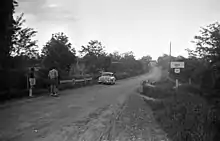
Ortseingang von Südwesten (1950)
This article is issued from Wikipedia. The text is licensed under Creative Commons - Attribution - Sharealike. The authors of the article are listed here. Additional terms may apply for the media files, click on images to show image meta data.