Gouzeaucourt
Gouzeaucourt ist eine französische Gemeinde mit 1.475 Einwohnern (Stand: 1. Januar 2019) im Département Nord in der Region Hauts-de-France. Sie gehört zum Arrondissement Cambrai und ist Teil des Kantons Le Cateau-Cambrésis (bis 2015: Kanton Marcoing). Die Einwohner werden Gouzeaucourtois genannt.
| Gouzeaucourt | ||
|---|---|---|
_Nord-France.svg.png.webp)
|
| |
| Staat | Frankreich | |
| Region | Hauts-de-France | |
| Département (Nr.) | Nord (59) | |
| Arrondissement | Cambrai | |
| Kanton | Le Cateau-Cambrésis | |
| Gemeindeverband | Cambrai | |
| Koordinaten | 50° 3′ N, 3° 8′ O | |
| Höhe | 95–137 m | |
| Fläche | 12,21 km² | |
| Einwohner | 1.475 (1. Januar 2019) | |
| Bevölkerungsdichte | 121 Einw./km² | |
| Postleitzahl | 59231 | |
| INSEE-Code | 59269 | |
| Website | http://www.gouzeaucourt.fr/ | |
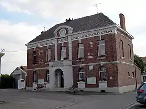 Rathaus von Gouzeaucourt | ||

Geografie
Gouzeaucourt liegt etwa 15 Kilometer südsüdwestlich von Cambrai. Umgeben wird Gouzeaucourt von den Nachbargemeinden Villers-Plouich im Norden, Gonnelieu im Osten, Villers-Guislain im Süden und Südosten, Heudicourt im Süden und Südwesten sowie Metz-en-Couture im Westen.
Bevölkerungsentwicklung
| Jahr | 1962 | 1968 | 1975 | 1982 | 1990 | 1999 | 2006 | 2013 |
| Einwohner | 1.263 | 1.260 | 1.237 | 1.286 | 1.377 | 1.253 | 1.376 | 1.552 |
| Quelle: Cassini und INSEE | ||||||||
Sehenswürdigkeiten
Siehe auch: Liste der Monuments historiques in Gouzeaucourt
- Kirche Saint-Quentin
- Britischer Soldatenfriedhof

Kirche Saint-Quentin
Literatur
- Le Patrimoine des Communes du Nord. Flohic Editions, Band 2, Paris 2001, ISBN 2-84234-119-8, S. 1153–1155.
Weblinks
Commons: Gouzeaucourt – Sammlung von Bildern, Videos und Audiodateien
This article is issued from Wikipedia. The text is licensed under Creative Commons - Attribution - Sharealike. The authors of the article are listed here. Additional terms may apply for the media files, click on images to show image meta data.