Averdon
Averdon ist eine französische Gemeinde mit 688 Einwohnern (Stand: 1. Januar 2019) im Département Loir-et-Cher in der Region Centre-Val de Loire. Sie gehört zum Arrondissement Blois, zum Kanton Onzain und zum Gemeindeverband Agglomération de Blois. Die Einwohner werden Averdonais genannt.
| Averdon | ||
|---|---|---|
| ||
| Staat | Frankreich | |
| Region | Centre-Val de Loire | |
| Département (Nr.) | Loir-et-Cher (41) | |
| Arrondissement | Blois | |
| Kanton | Onzain | |
| Gemeindeverband | Agglomération de Blois | |
| Koordinaten | 47° 41′ N, 1° 18′ O | |
| Höhe | 87–131 m | |
| Fläche | 29,24 km² | |
| Einwohner | 688 (1. Januar 2019) | |
| Bevölkerungsdichte | 24 Einw./km² | |
| Postleitzahl | 41330 | |
| INSEE-Code | 41009 | |
| Website | https://www.averdon.fr/ | |
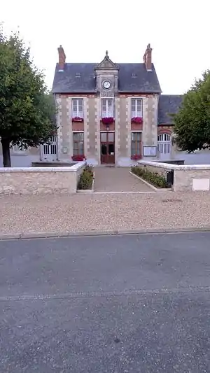 Rathaus (Mairie) von Averdon | ||

Geografie
Averdon liegt etwa zehn Kilometer nordnordwestlich von Blois am Cisse. Umgeben wird Averdon von den Nachbargemeinden Champigny-en-Beauce im Norden und Nordwesten, Conan im Norden, Maves im Nordosten, Mulsans im Osten, Villerbon im Südosten, Marolles und Fossé im Süden, Saint-Bohaire im Südwesten sowie La Chapelle-Vendômoise im Westen.
Bevölkerungsentwicklung
| Jahr | 1962 | 1968 | 1975 | 1982 | 1990 | 1999 | 2006 | 2017 |
| Einwohner | 355 | 348 | 427 | 605 | 631 | 643 | 697 | 697 |
| Quelln: Cassini und INSEE | ||||||||
Sehenswürdigkeiten
- Menhir La Grand Pierre
- Kirche Saint-Lubin, Monument historique
- Nekropole de la Grand Mesle; prähistorisches Gräberfeld
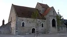
Kirche Saint-Lubin

Nécropole de la Grande-Mesle
This article is issued from Wikipedia. The text is licensed under Creative Commons - Attribution - Sharealike. The authors of the article are listed here. Additional terms may apply for the media files, click on images to show image meta data.