Abrahámovce (Kežmarok)
Abrahámovce (deutsch Abrahamsdorf, ungarisch Ábrahámpikfalva – bis 1892 Ábrahámfalu) ist eine Gemeinde in der Ostslowakei.
| Abrahámovce | |||
|---|---|---|---|
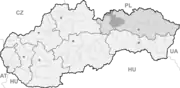
| Wappen | Karte | ||
 |
| ||
| Basisdaten | |||
| Staat: | Slowakei | ||
| Kraj: | Prešovský kraj | ||
| Okres: | Kežmarok | ||
| Region: | Tatry | ||
| Fläche: | 6,65 km² | ||
| Einwohner: | 274 (31. Dez. 2020) | ||
| Bevölkerungsdichte: | 41 Einwohner je km² | ||
| Höhe: | 713 m n.m. | ||
| Postleitzahl: | 059 72 | ||
| Telefonvorwahl: | 0 52 | ||
| Geographische Lage: | 49° 3′ N, 20° 26′ O | ||
| Kfz-Kennzeichen: | KK | ||
| Kód obce: | 523399 | ||
| Struktur | |||
| Gemeindeart: | Gemeinde | ||
| Gliederung Gemeindegebiet: | 2 Gemeindeteile | ||
| Verwaltung (Stand: November 2018) | |||
| Bürgermeister: | Stanislav Lapko | ||
| Adresse: | Obecný úrad Abrahámovce číslo 56 05972 Abrahámovce | ||
| Statistikinformation auf statistics.sk | |||
Der Ort wurde 1286 zum ersten Mal schriftlich als Abraham erwähnt. Zu ihr gehört der 1892 eingemeindete Ort Pikovce (deutsch Picksdorf, ungarisch Pikfalva).
Sie hieß bis 1927–1952 slowakisch Abrahamovce-Pikovce, bis 1982 Abrahamovce.
Weblinks
Commons: Abrahámovce (Kežmarok) – Sammlung von Bildern, Videos und Audiodateien
This article is issued from Wikipedia. The text is licensed under Creative Commons - Attribution - Sharealike. The authors of the article are listed here. Additional terms may apply for the media files, click on images to show image meta data.